1978 North Country Trail (NCT) Thru-Hike
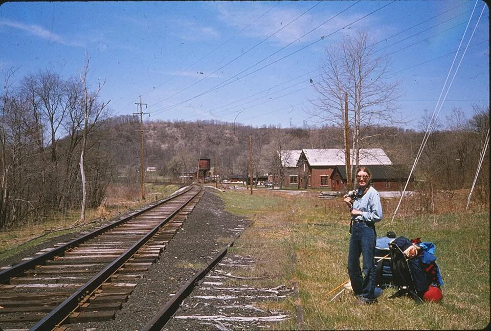
Lou Ann Fellows and Carolyn Hoffman on 1978 end-to-end.
Last week we stumbled upon an interesting post on the North Country Trail (NCT) Community Facebook page. A gal by the name of Carolyn Hoffman had posted a picture of the beginning of what would be a seven-and-a-half-month-long journey "along what was then no more than the proposed route of the trail" in 1978. Out of five people that began, only two would complete the trek - Carolyn and Lou Ann Fellows.
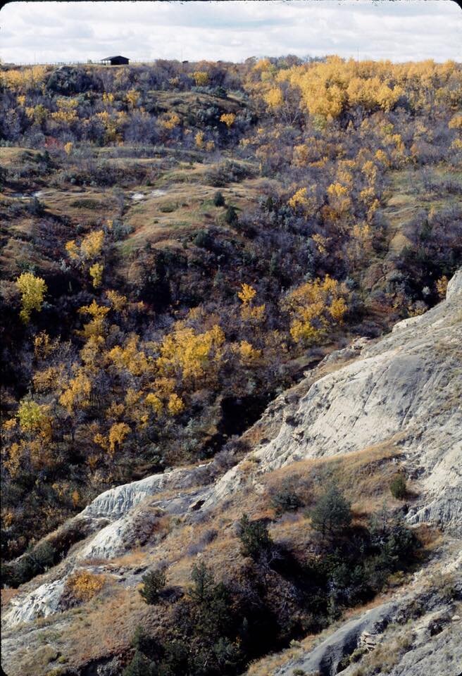
If you're unfamiliar with the NCT, it stretches from Vermont to North Dakota, including 96 miles that run through our backyard here in the Allegheny National Forest. I've collected many moments with family and dear friends under the canopy on this trail over the years. It is, indeed, a very special place.
It's such a young trail even today, I cannot imagine the adventure (and the gear!) in 1978. Well, I couldn't until Carolyn came along. She has given us permission to update this blog post weekly to include new stories she shares, for those that may not use social media. Hope you enjoy it as much as we have.


We hiked into the town of Canastota along the canal. By this point, the guys were complaining about not yet having had a day off from hiking, so they stayed in the town while Lou Ann and I hiked ahead. They thought this was an ideal solution since they could hike so much faster than the two of us. This way, they reasoned, we “wouldn’t hold them up.”
The next day (March 23, 1978) in Kirkville NY we rejoined the men and sent the snowshoes back to Lance Feild in Maine. We hadn’t used the ‘shoes in days, and the longer we walked the less snow we saw. Kirkville was a really small town that had a post office and a gas station with a soda machine and little else. We had lunch there, eating out of our packs but taking advantage of the soda machine.
At one point we saw two old farmers chasing a muddy old draft horse around a muddy pasture on the other side of the canal. We yelled back and forth across the canal. They asked us what we were doing and we shouted back and forth, providing as much detail as possible over the width of the canal.
In Fayetteville T called a friend he’d worked with at a hiker’s lodge in the Smoky Mtns, who picked us up in a tiny compact car, a Pinto I think. We tied a couple of the packs into the trunk and on top of the car and squeezed into the car, me sitting between seats with the stick shift between my knees and a pack on my lap. It was like a clown car or one of those phone booth challenges (remember those?) we were stuffed in so tight. The car was definitely not made for six people, five with expedition-sized packs. It’s a wonder that poor little car could move. After a night of civilization, and baths (!) T’s friend took us back to Fayetteville and we struck out again.
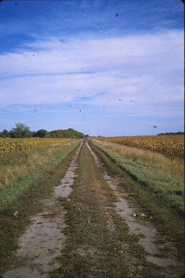
Our hike was now taking us through a very rural area of low, broad hills, mostly farmland with a mile or more between houses. I remember being able to see for miles. That next day we hiked 14 miles to Fabius, all on paved rural roads. The roadwalking, as always, was killing. In the early afternoon we all thought we would soon reach the town because we passed a sign announcing we were entering Fabius. Unfortunately for us, the sign wasn’t for the town limits, just for the edge of the surrounding township, so we still had several more feet-killing miles before we reached the town.
At the small post office, we discovered that our next batch of topographical maps had arrived, but not our food packages. As a result, we decided to spend the night nearby, hoping the food would arrive the next day. Fabius didn’t have a hotel, so after discussions at the post office and with the local police, we stayed in the garage of this burned-out house just down the road from town. It turned out to be a very cold place.
We were about half a mile from the town bowling alley, so Lou Ann and I walked back there to make phone calls home, use their restroom and get warm. The guys all claimed to be tired and didn't walk back to the bowling alley with us.
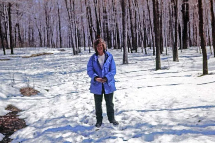
I’ve looked and looked but can’t find a photo from this day but here’s one of Lou Ann taken a week or so earlier in the trip
The three men always hiked faster than Lou Ann and me during our NCT route hike, but we always managed to reconnect and find them again when it was time to set camp. To those of you who’ve never been without a cellphone, it's likely a surprise how easily we had regularly reconnected with them. It wasn’t unusual for them to have reach a camp site and have their tents set up and dinners cooking before we even got there. We developed our own method of finding each other. If we were camping in a spot illegally, a frequent occurrence in this rural landscape, the men would leave articles of gear, usually a boot, at the spot where they left the trail. The gear was a signal to Lou Ann and me that they’d found a hidden camp spot and that we should venture off the trail or road to look for it. Usually they placed the item in a conspicuous spot on a rock or up against a tree. Following behind them, we would see the gear and then know to head off the trail or the road and look for them, retrieving the gear as we did. This night it was a boot by the side of the road, and we headed back into a mature pine plantation at the far end of a large cow pasture. The barn and house weren’t visible from the trees. It was a lovely spot to camp, with the sound of the breeze through the pines.
For 3 weeks this method had worked well for us. We couldn’t know that tomorrow it would fail us utterly.

The next day was March 25,1978, Easter weekend. We knew nothing in the small towns we were walking through would be open, so we had no reason to hurry. As usual, the 3 men hiked faster and ahead of Lou Ann and me. This day’s walk was again all on back roads, with many turn-offs and side roads. Our plan was the usual one. We’d hike until late afternoon, the men would find a place to camp and leave an article of gear along the side of the road to let us know where they were. So we walked and along about 4 or so started keeping an eye out for the gear. We didn’t see anything so we kept walking and walking. And walking.
Eventually, we hiked 17-18 miles and reached the small town of McGraw NY not long before sunset. We certainly didn’t plan to hike that far. We wondered if the guys just kept walking because they wanted to get somewhere for a drink or grocery shopping before the holiday closed everything. But once in town we checked the local bars and the post office and no one had seen them. Almost no one was around town on this holiday weekend and those who were hadn’t seen them. One person thought he might have seen them at a twisted road sign around 4:30 pm. We knew the guys planned to hike until around 5, which should have gotten them to McGraw at the speed they hiked. So we wondered if they’d been confused by that twisted sign and taken the wrong road.
The woman who owned the Empire Inn found us a place to stay for the night. I remembered my feet throbbed so much that it was after midnight before I could fall asleep. We wondered if this possible wrong turn took the men a while to figure out. The next morning, the woman bar owner fixed us a huge breakfast. Lou Ann and I hung around for a while, figuring the guys would show up in a few hours. But they didn’t. More about that tomorrow.
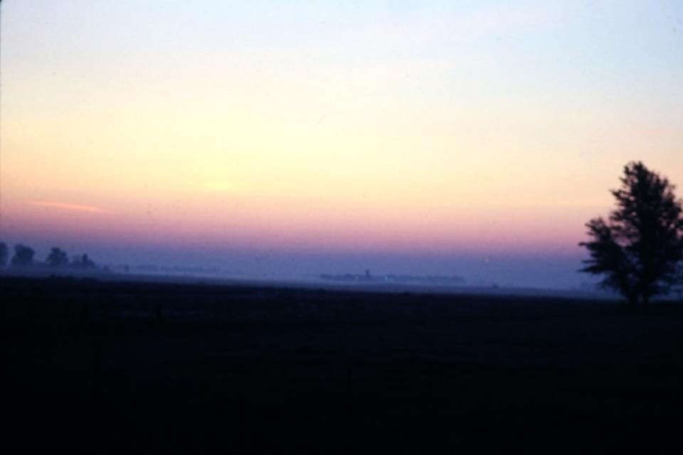
I’m not sure today’s photo is from that day or not but it’s close. Spring was starting to spring.

In McGraw we waited for the 3 men to arrive. We figured if they didn’t walk all the way to town the day before, they would reach McGraw in 2-3 hours from wherever they were. They didn’t arrive by noon. They didn’t arrive by 3 pm. Lou Ann and I had no idea where they were or what was going on. We wondered how we could have missed seeing the boot by the side of a narrow road with almost no shoulder. We wondered if they somehow looped around McGraw entirely and were instead somewhere up ahead of us yet again. So after much discussion, we were convinced they were now far ahead of us, essentially a full day’s walk ahead, and the only way to rejoin them was to get a ride to the next town and wait for them there. So we got a ride to Slaterville Springs in pouring rain with an elderly couple who didn’t have anything else to do that afternoon.
But the men weren’t in Slaterville Springs either.
The town was really little more than a village. It had a store, a post office and a fire hall. We stayed in the firehouse, courtesy of the firemen.

From my trip journal
“3-27-78 – Monday
“Heard about the guys, second hand, this morning in Slaterville Springs. They called the PO and told him [the postmaster] they were in McGraw after ‘taking a day off’.”
At this point we had no other details. When we got a ride to Slaterville Springs, we figured that since they didn’t show up in McGraw by 3 p.m. that they had continued walking, thus putting us behind them again. Now we found we were way ahead of them.
Lou Ann and I spent much of the day wandering around the small town and speculating why the guys had “taken a day off.” We pumped the poor postmaster for every scrap of detail, every voice inflection, but we didn’t get much beyond what he’d told us the first time.
Lou Ann and I tried to figure out what had happened. After constantly being behind the guys, it was hard for us to understand just how we now managed to get ahead of them this time. We wondered if they’d taken a different route into McGraw, but we couldn’t figure out how or why they would have turned off the road to do that. We wondered why, after being separated like this, they were now “taking a day off” instead of getting back together with us.
The next day (Tuesday) we were still separated. Now we still didn't know where the guys were, only that they were going to take a shortcut cross-country to catch up with us. So we walked on, along back roads, up steep hills that gave us impressive vistas of farmlands surrounded by steep mountains. A Holstein cow followed us a short distance along the road until it wandered off into its owner's (presumably) yard. Sometimes I felt as though I could see Rip Van Winkle in those deep valleys. I almost expected Revolutionary War soldiers or Native Americans. The road walking took its toll, but the views were great. I remember sun, followed by snow squalls, followed by rain and big black clouds racing across the sky. We didn’t see many people, and I liked the wide valleys that afforded great vistas, unlike my home in Pennsylvania, which has deep, narrower valleys, without such spectacular views that go on for mile upon mile.
Lou Ann and I spent the night in Newfield New York, after what I described as "the toughest 12+ miles I've ever done." We camped in the local Methodist Church, after asking a cashier at the local grocery store where we might stay. She suggested we call the pastor, who arrived about five minutes after we called and took us to the church. We stayed in the church basement, which had a kitchen and seemed like a great luxury to use instead of our backpacking stove.

The only thing we really knew about the three guys at this point was that they were determined to make our March 30 mail drop in Watkins Glen, so we figured we would meet up with them there, if not before.
Lou Ann and I left Newfield the next morning, with plans to follow a series of old woods roads. We'd hiked about four miles when we arrived at our next woods road that was still covered with deep snow. We were surprised by the snow, as virtually no snow was left anyplace else and what was left certainly wasn't deep. But this old farm road was sheltered from the sun on the north side of a hill, winding narrowly through a deep pine forest. We took a few steps along it, soon up to our knees in snow and came to the conclusion that going forward along this route was impossible. So we turned back and after walking 8 miles were right where we started the day. It was now noontime and once again we were pushing against a weekend and needed to get to Watkins Glen before the post office closed for a day and a half. We found a ride to take us south.
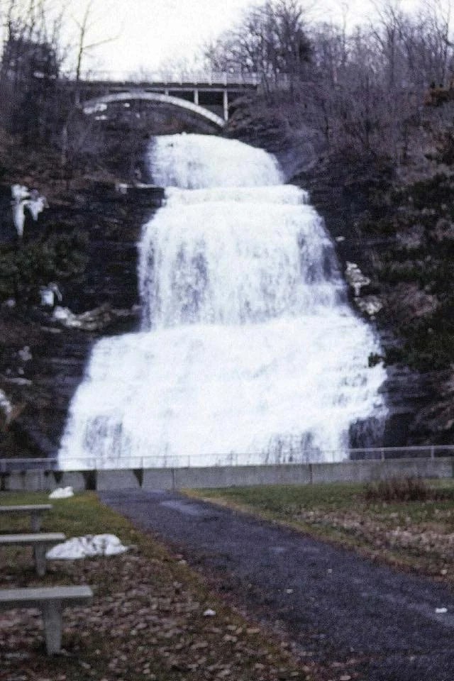
We arrived in Montour Falls, just south of Watkins Glen. This is a really pretty little town, with a long Main Street that comes to a dead end right in front of the falls for which the village is named. We stayed in the top floor of the firehouse, right next to the falls. The old Victorian-era fire hall had a large open space on the second floor, with big windows and a high ceiling. We could hear and see the falls from our vantage point.
Lou Ann and I set out the morning of March 30, 1978, towards Watkins Glen, just a few miles down the road, hoping we would find the three men in town. Imagine our surprise as we were walking along the road, when people started greeting us and waving to us and stopping to have their pictures taken with us. The local newspaper did a story about us and we were recognized from that story.
As we neared the town, we suddenly found R, T and F, who arrived along the road by car from somewhere. They were out of the car and walking with us within a few minutes. As we got closer to town, the postmaster arrived and also walked with us, telling us about our mail. Over 100 pieces of mail awaited us, plus 15 packages. Watkins Glen was a whirlwind of interviews, opening mail and people just wanting to talk with us. The postmaster arranged for us to sleep in a local gym.
Several of us wanted to go into the gorge of Watkins Glen. We were told it was “closed” for the winter but that we could walk around the gate to get in and that’s what we did.

More from Watkins Glen:
We were soon so busy I didn’t have time to get details from the guys about their sojourn away from us. We were rushed from the mayor’s office to the police station, to lunch, to an interview, back to the gymnasium, carrying tons of mail and trying to figure out what to do with it all.
Later in the afternoon, I was anxious to get into the glen to take photos. I’d been here once before as a child with my parents and grandparents on a short summer vacation. I remembered it as a very beautiful spot and wanted a chance to see it again and take some photos without the encumbrance of a backpack. F. went along. R’s foot was bothering him so he didn’t go along. Lou Ann was tired. I think T. was still reading his girlfriend’s letters.
Technically, the glen was closed for the year, but the locals didn’t make a fuss as we went into the canyon. Like the road Lou Ann and I couldn’t hike the day before, the spot was deep and dark, ice and snow-covered and probably dangerous. The glen was narrow, covered with ice tinged with blue and pink. It was beautiful and quiet, except for the water rushing under the ice. I took nearly a roll of pictures here, climbing all around.

While I was in Watkins Glen, I learned afterwards that R went to the emergency room to have his foot looked at. The doctor there told him he had to stay off of it for two days "or it would swell up like a watermelon." His foot problems were a surprise to me, as R was our strongest hiker, easily able to walk 25-30 miles a day, while I struggled to get much above 15 miles a day without paying for it in aching feet.
The guys weren’t very descriptive about what they did while we were separated. They couldn’t figure out how we didn’t see the boot they’d left by the side of the road. They couldn’t figure out why we kept walking, as to them it was obvious that we were ahead of them. So now that we were back together, we just focused on the next day’s walk and not on what happened several days ago.
R decided he would try and catch up with us before Salamanca, New York. In this area, the trail followed a dome-shaped route, and he planned to walk across the "bottom" of the dome so he could rejoin us without hiking as far as we would.
When we left Watkins Glen we hiked to near the town of Monterray on a warm, beautiful day, the warmest so far.
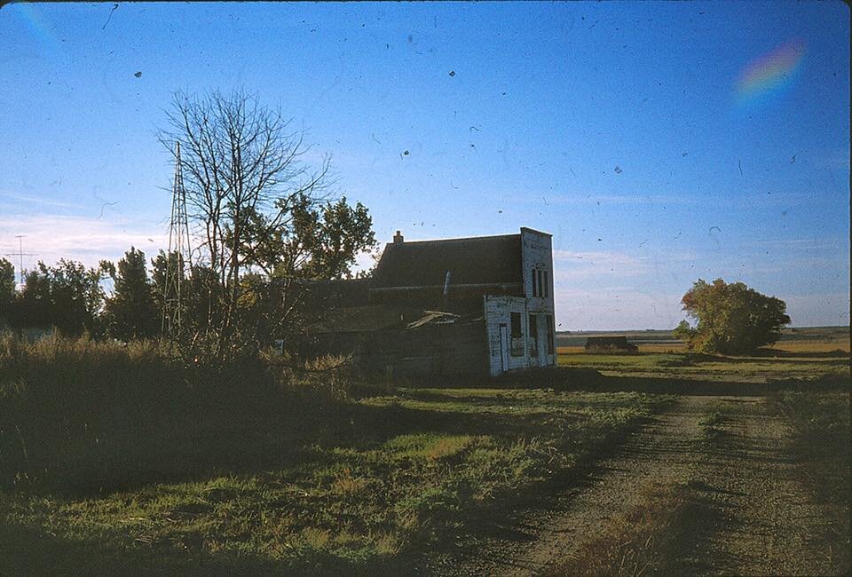
After 40 years I remember lots about the hike, but I’ve forgotten some of the order of the days. I was thinking that we stayed in the old barn/ garage (the photo where I’m wearing the red plaid jacket) a couple of days before Watkins Glen, but it was actually the night after leaving here.
From the bar that was in front of the old barn, I called home and learned that my parents had arranged with a neighbor to stay in his cabin overnight when we reached Allegheny National Forest in PA.
So rather than post the barn photo again, I’m posting another one from Watkins Glen.
So Lou Ann and I got a ride into Westernville NY another day or so ahead of the men. There we had another mail drop and did several interviews for the Rome newspaper and radio stations. Westernville was a lovely little town, very picturesque, especially General Floyd’s home, a signer of the Declaration of Independence. From here I was ready to be hiking again. We would also be walking along the Erie Canal towpath, which would be flat and easy walking. We met up with the men, using the note on the post office window routine again. And we were all hiking again

Lou Ann and I next hiked into the village of Energy and stayed with a family in their guesthouse called “the Doghouse.” Energy is a village only about a mile west of McConnells Mill State Park and just north of the slightly larger village of Duck Run. Sometimes it must seem as though my journal is more about where we spent the night and who we stayed with than about hiking. To some extent, particularly in the early part of the hike, that is true. At this point I was using my journal mostly to keep track of people’s names and what they did for us, as we planned to write thank-you notes to those people when we reached the end of the trail. I think my photos give a better idea of what we did and what we saw than my words during this time.
The covered bridge was near McConnell’s mill and the second photo is of the mill itself


We were making good time on our bikes, though by May 5 we were hampered by heavy fog and rain, and while that burned off, it was followed by heavy wind that made biking difficult. We were still getting used to the bikes, and this section of Ohio was hillier than the previous days. Heading uphill with full bike bags was at least as hard as backpacking uphill but was more awkward.
Spring was finally in evidence everywhere, with tulips blooming. We stayed at a campground at Tappan Lake and took full advantage of the hot showers there. We did another interview, met the local postmistress of Deersville, who kindly did our laundry. The next morning, it looked like rain again, but we managed to make 12 miles to Freeport before the rain let loose again. We hung around there for nearly four hours, hoping the weather would improve. I noted i my journal that I finished War and Peace during this brief hiatus and was starting on The Three Musketeers.
The photo of Lou Ann shows just how rainy it was! The photo of me was taken earlier, about the rime we crossed from PA to OH
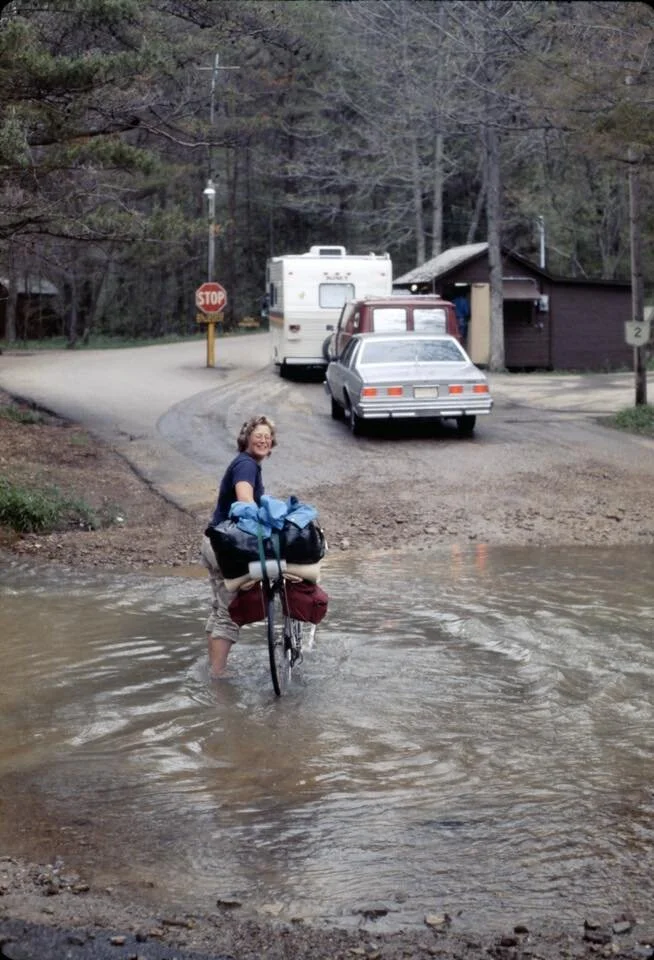
When the rain let up, Lou Ann and I headed out on our bikes again, only to be stranded a few miles later when the rains started again, this time with no place to find shelter. We ended up at a township's road shed but couldn't stay there. Still, one of the crew knew of a nearby church. He loaded us and our bikes into his truck and took us there, where we ended up spending the night with the pastor and his family.
The next morning, the sky was as imposing as ever, but we still headed out, dodging raindrops all morning. We made it as far as Senacaville OH where we stayed in another church, arranged by the pastor from the previous night.
The next day, May 6, the rain held off but still always looked imminent. We added about 42 miles to our trip and slept in a picnic area north of Rinard Mills in view of a very dilapidated covered bridge. We chatted with a few fellow cyclists. They were on a D.C. to Chicago trip and came complete with all the right gear--helmets and toe clips. They told us they were averaging about 100 miles a day. We must have looked pretty shoddy next to them.

Because Lou Ann and I were now making good time, we often took a little time to better see the surrounding country. We stopped at Morrison's Country Store & Post Office, where we were soon overheated by a huge potbellied stove. The owner said "Ye-ah" to everything that was said, even when he didn't know what we were talking about. We traveled up the road a few miles to the village of Marr OH, a town of about two houses and two buildings and yet another general store. This one was Park's Store, and boasted yet another huge pot-bellied stove.
The owner of the store in Marr was no less a character than the man at Morrison's General Store. He and his regular customer were quite the storytellers, insisting that the nearby Native American mound was fake. He claimed his brother owned it before the government, allegedly discovering it while lumbering there. He further claimed the image of a circle on the mound, which was visible from the air, was simply the result of planting a single row of corn around and around the mound during the 1930's. He was deadly serious when he told us this story and fully expected us to believe it.
Even 40 years ago in 1978, Marr and its general store (its exterior is on the right in the first photo) was a place that seemed unchanged in 50 years


The next day, May 20, 1978, LouAnn had a biking accident, ended up the hospital with a bruised kidney and fractures of two bones in her vertebrae, and I didn't write in my journal for several days.
Here's what happened: we were going down a big hill, a really big and steep hill, near Ft. Ancient, just north of Morrow, Ohio. About two-thirds of the way down was a hairpin turn. I made the turn, just barely, but Lou Ann didn't. I was behind her, and she was far enough ahead of me that I didn't see the accident, but I saw her laying on the edge of the road. I tried to stop but the hill was too steep. My brakes were slowing me down but not enough to stop the bike. I yelled at her as I went past, "I'll be back." At the bottom of the hill, I finally was able to stop the bike, tossed it by the side of the road and went running back up the hill to LouAnn. She was conscious but hurt, told me not to move her, and I went for help back down the hill again where I found a house where someone fortunately was home and called an ambulance. When the paramedics picked her up, LouAnn took one glance at one of them and said "Blair?"
Now you have to understand that Lou Ann had never been East before and really didn’t know anyone from this half of the country, let alone someone from Ohio or someone from Morrow, Ohio. So the idea that the EMT who picked her up from the side of the road could possibly anyone that she knew was essentially astronomical. But first things first.
So Lou Ann is loaded in the ambulance, and fortunately they let me ride with her. I was afraid that if I couldn’t go with her, I’d never find her again as of course there were no cell phones. I had no idea where anything in this area was, let alone a hospital or how far away that hospital might be. So I was determined to stick with her.
While in the ambulance, I soon found out that Blair was someone Lou Ann had met on a NOLS course taken some time before. And he was one of the ones who came in the ambulance. How astonishing is that?
Blair was a stand-up guy. I ended up staying with him for a few days while I waited for more news about Lou Ann. She told me she had a bruised kidney and had broken off several pieces from the vertebrae in her back. I called her mother to tell her what happened, and she arrived a day or so later from California.
Sometime during these days we learned Lou Ann would need to be off the trail for several weeks. Sometime also that first day, Blair drove me back to the scene of the accident where I retrieved our bikes and our gear. The guardrail had broken Lou Ann’s fall, and her bike ended up some 30 feet down a ravine, though surprisingly it came through the accident in pretty good shape.
After the first few days of just spending the days in the hospital room with Lou Ann, we started to plan what would happen next. Lou Ann would go home to California with her mother to recuperate. I would go on alone, with the understanding that when she was ready, she would rejoin me somewhere in Michigan. So that's what we did.
All told, I spent four days hanging out in the hospital. Lou Ann spent several more days there after we parted, until she was well enough to sit on an airplane. I headed out again on May 24, this time, my first time, as a solo traveler. It was hard to say goodbye to Lou Ann, and I dawdled until 10 a.m. at the hospital. But there was no use putting off the separation any longer, and eventually I was traveling again.
And then I reached Grand Rapids, where I somehow became a celebrity for a day. The cause of my celebrity status was the local town treasurer, who was also a hiker. I ran into him at the local post office where I recovered my pack, as I planned to resume hiking here. From there I was introduced to a regional trail worker, did two newspaper interviews, a TV interview and met many more people, all while I was trying to repack my gear from the bike back into my backpack.
In the evening, another local trail person took me grocery shopping. I had a great time meeting everyone, but it was a lot of activity, and I was soon exhausted. My pace of life on the trail was much slower than meeting 20 people in a day and bouncing from here to there.
After more activity the next morning, I finally headed out again, accompanied by several of the local hikers for a few miles before finally being alone again. After weeks of biking, backpacking was difficult again, and by early afternoon my feet and hips hurt, and I was tired and grouchy. I quit for the day after just 9 miles, camping in someone's field for the night.
In my journal I wrote, "I shouldn't have quit so easily [today], especially when I was capable of moving on after a bit of a rest. But I was tired after a midnight turn-in time, and the fast pace of the day before just got to me. So I've relaxed this afternoon, and I do feel better. I know, though, it'll take me a while to get used to ‘packing again. I'm optimistic that I can do better & pretty well tomorrow, weather permitting, of course.”

The next day, after a good night's rest, I was on the move again and managed 11 forward miles. I also took a slight detour to the nearby Moose Hall golf course because I figured the clubhouse would have a phone where I could call home. They did and I reported enjoying the phone call as I got to talk to everyone at home, which included my grandfather and sister, as well as my parents. Just as exciting to a long-distance backpacker, or at least nearly so, was that the clubhouse was having a special steak and egg breakfast for $2, a feast I wasn't about to pass up.
When I headed out again, I was only a mile down the road when I came to a country store where the proprieteress gave me a free Polish sausage and where I bought another book to read in the evenings. Along the country road I ran into several people who recognized me from either the newspaper or the TV interviews, and one of them gave me a Coke. So I was pretty well tanked up by the time this day ended!
The color has shifted on today’s photo. Some of my photos from this trip are fine, others less so. I didn’t always have much choice about what camera film to buy. I pretty much took whatever I could get.

The next day (I think my dates were still a bit off) the weather was cooler and I hiked 15 miles in 6.5 hours to reach Walkerville MI. There I got new socks, having walked through at least one of the two pairs I carried with me. I noted that the socks made the day easier than usual. I stayed with another family and joined them for a backyard cookout. I called both my home and LouAnn. She reported she was "raring" to go and rejoin the trip but noted it would still be weeks before she'd be able to hike with me again.
It was now mid-June, 1978, and the next day was hotter again, though I hiked about 12.5 miles. Still, at the end of the day my feet were tired again, so that "new sock" feeling only lasted one day. This part of the hike was in largely mostly wooded, with small or medium-sized farms jutting up out of the forest. I met a few of the farmers--they didn't get many passersby. One woman gave me a belt to hold up my now too-loose jeans, but we first had to give it another hole. Down the road just another mile or so was her brother's farm, who gave me the okay to walk along a private two-track road that traversed their lands.
The next day my hike along Lake Michigan’s shoreline continued, but I only covered about 9 miles to reach the town of Manistee. There I did a lengthy interview with Doug Coombs, the newspaper's outdoor editor. The interview was so lengthy that I never got back to hiking that day and ended up spending the night at Doug's apartment and got taken to dinner that evening.
The next day I planned to hike a good bit further, but after 3 miles or so pouring rain, fog and worst of all, wet sand, ended my day. I watched a dark gray storm front inch its way across the lake, and I knew a storm was imminent.
I ended up camped in Orchard Beach State. After dark Thunderstorms--great, hour-long storms of lightning and noise penetrated the fog. The rain was so heavy and the fog so dense that edges and colors were obliterated, and I struggled to recognize even familiar shapes. Thunder boomed through the fog, and wind gusts rippled the tent walls but didn't shake its foundation.
The storm went on pretty much all night. I even felt the earth shake from the lightning strikes. I was glad to be in a tent and not one of the few metal motor homes at the campground. I hoped that lightning was far more likely to hit one of those than my much lower-to-the-ground tent.
The storm finally abated around dawn, and I can report I successfully survived the worst thunderstorm I’d ever seen, let alone camped out in. It was a scary and very sleepless night.
The next day my goal was to reach Interlochen State Park where I met Senator Dick Allen, had a small news conference, and then we hiked together for about 7 miles through Fife Lake State Park. Sen. Allen was a veterinarian before he became a senator and he was an enjoyable companion.

The next day, I walked another 12 miles to camp along Boardman Creek. The day was a fairly easy hike, mostly on gravel roads in Fife Lake State Forest. The date was June 19, but I noted frost overnight, with ice crystals covering the plants like a dusting of powdered sugar. It didn't last past sunrise, of course. I could almost see the ice turn to water droplets before my eyes.
I spent the next night in Kalkaska, mostly because I needed some time to work up my next batch of maps and write and send letters.
I met a Native American man from northern Alberta at Fork's Campground. I figured him for somewhere in his late 40's so was surprised when he told me he was retired. That evening around a roaring campfire, I told him about my hike, and he told me stories of his uncles who during their prime years and even into old age ran winter traplines for five months of the year. They used packdogs--those giant, gentle Newfoundlands, which carried up to 100 pounds of traps, gear and pelts, while their masters snowshoed along the traplines, each several hundred miles.
By late June 1978 I was in Boyne Falls, Michigan, where I had a mail drop and picked up a lot of mail. I stayed an extra night there, just trying to answer all of it and get my letters sent before starting to walk again.
My next stop was Petosky, the last few miles were along a major highway. I started walking along the four-lane but soon ran into two construction workers I'd met the day before in Boyne Falls, and they gave me a ride so I wouldn't have to walk along the four-lane, which was pretty scary going in the few miles I did walk along it.
I ended up staying in Pellston on July 1, where I met a family who knew the Dillsburg native whose through-hike on the Appalachian Trail sparked my interest in long-distance hiking. The man met my Dillsburg friend during his own AT hike. I got to see his AT slides, so it was a fun evening.
Around July 10, 1978 I was at Soldier Lake Campground in the UP. The night before was a chilly one for summer. I found out the temperature was 38°F. I hiked all this day on just half a canteen of water, as the campground the night before had no water, and I didn’t find any place with water in between. So I was very dry till I got to Soldier Lake and spent a couple of hours doing little more than drinking water.No water at Dick Campground as expected. Was very dry when arrived here & have been drinking ever since. Have I was also able to wash myself here for the first time in several days, though I was really looking forward to someplace where I could get an actual shower.
Lou Ann and I were planning to reunite at the campground near Tahquamenon Falls, though I reached there a few days before she did.
While camping on July 12 I was invited to the campsite “next door” to sample some campfire-baked apple pies made in a pie-maker. They were delicious & I also enjoyed the company. A friendly family took me into a town to get supplies. The postmaster in Eckerman told me that a lumber truck driver who had nearly blown me off Dick Rd. the day before had just moments before seen a big bear just around the bend from where he saw me. He swung wide to avoid the bear only to encounter me on the other side of the bend. I never saw the bear. I’m just missing seeing bears everywhere it seems.
This area is truly beautiful. I spent part of the day walking in the area & taking pictures. The water sparkled like blue-green jewels. The tall swamp grass rippled in the wind and looked like the lush green pelt of some strange furred animal. An osprey flew from the size of a small white speck down river until it was over my head—large & silent, casting a shadow like an airplane.


As might be expected in the pre-cellphone era, Lou Ann’s and my reunion at Tahquamenon Falls took a while to straighten out. On July 14, a Friday, I expected her to arrive, and I was waiting for her at a campsite there. When she didn’t show up when I expected, I called her home and found out she left California as planned, and everything seemed to be according to schedule. Except I didn’t know where she was.
It was Sunday morning before we finally got back together. Somewhere along the way, I discovered Lou Ann was at a campsite at the Lower Falls, where she arrived Friday evening. I was at a campsite at the Upper Falls. At that point we didn’t know there were different camping areas here.
But once back together it was all water under the bridge or maybe under the falls.
We spent the rest of Sunday talking, getting groceries, repacking our packs and the like. Now, we could hike together again and make some time. Except it didn’t quite work out that way. More about that tomorrow.

The next morning Lou Ann and I eagerly started hiking again, following the North Country “pathway.” We talked with the ranger who’d marked the route with blue ribbons. He said he’d done the work last winter while on snowshoes. The plan was to actually blaze the path this next winter or fall after most of the campers had left the area. He told us the ribbons were pretty frequent, at least as frequent as blazes would be and that we wouldn’t have any trouble following them. We’d hiked about eight miles, easily following the ribbons as promised. But then we ran into a swamp, complete with beaver dam. Apparently the ranger didn’t know and couldn’t tell when everything was frozen that his pathway was a swamp. We tried to work our way through it, and at one point I went up to my knees in the dark, fetid water. Once out of that unexpected mess, undaunted, we changed socks and moved on. Unfortunately, however, we soon came upon another beaver dam, this one the largest one I’d ever seen. Worse, the ribbons seemed to end there, as well. So now we had no choice but to retrace our steps and call it a day. We ended up camping that night along the Tahquamenon River near where we’d taken a rest break in the morning.

On the morning of July 19, 1978, Lou Ann and I talked to another ranger at the upper Tahquamenon Falls about where the NCT was “ribboned,” as it wasn’t yet blazed. That’s when we found out the proposed path was laid out in winter. So the local rangers really didn’t know their planned path was impassible in summer, with swamp water up above our knees. We also visited viewed the upper falls on this day. It is about 50 ft. high, 200 ft. wide and was very red. Lou Ann and I both took many pictures of the falls and also the Tahquamenon R., which really looked like something out of the “Song of Hiawatha” or the “Last of the Mohicans.”


The next time I wrote in my journal I reported that we were camping along Lake Superior’s beach near but not at Muskellonge Lake State Park. We listened to the rain on our tent roof, the waves on the beach and the distant rumble of thunder that threatens to engulf us. Fog shrouds everything as it has, seemingly for days. After finding our camp for the night Lou Ann and I spent the late afternoon hunting and picking up stones along the beach. The beach is covered with millions of them. Many are the size of cobblestones (and have that shape and texture as well). Nearer the beach are smaller ones, pebble-size, in all shapes and configurations. The colors are spectacular, white and black speckled, clear quartz, red and black, orange, green. I thought I’d found one agate, and I took it with me. Months later when I got home, I found out that it wasn’t.
The rocks covered the bottom of the big lake like a cobblestone street underneath the pounding waves. The distant thunder grew ever closer, and I was constantly reminded of the song, “The Wreck of the Edmund Fitzgerald.” This evening, the waves were not more than 12-18” high, I had trouble imagining the lake as a frothy maelstrom that claimed a deep-lake freighter. Yet even then I knew that but four miles off shore the lake is nearly 400 ft deep.
As the storm got closer, the rain began in earnest, and occasionally a dull flash of lightning penetrated the fog. The rumbling thunder was muffled somewhat by LouAnn, next to me, playing “Streets of Laredo” and a jaunty English sea chanty on her harmonica. But it wasn’t long before the thunder grew too loud to be muffled we were in for another siege of it. We staked the tent on sand and I worried if it would hold, though we reinforced the major stakes with some of the larger rocks. We couldn’t do much else, and fortunately that was enough.


The storm overnight on July 19, 1978, put on quite a light show that lasted until well past 11 p.m. The worst of the lightning and thunder was 2-4 miles down the beach. But what we got was bad enough, especially the rain, which was very heavy. Despite my fears the sand underneath our tent didn’t turn to jello. Early in the morning of July 20, the wind really tore into us. Several times I was afraid the tent was going. But it held! We didn’t get hiking until after 10 a.m. because the early morning weather was still so awful. Once the wind died down slightly Lou Ann and I started hiking again. The wind kept up all day.
Later in the day the mist rolled in again to join its brother, the grey sky.
I could still hear the wind the evening of July 20, though I reported “sometimes it’s hard to distinguish the wind from the pounding surf.” We camped at Lake Superior Campground—another of the rustic, no pay campgrounds in Michigan.
Today was the day we first met another hiker, Dave S., who was going to be hiking the Pictured Rocks Trail, too. We first ran into him during the morning about half a mile up the beach from our last night’s camp. Then in the afternoon he came into the campgrounds, and set up next “door” to our campsite. Dave was new to backpacking but kept his pack weight down to 30 lbs, which was quite an accomplishment for someone new to backpacking.

I declared July 24, 1978 a “weird kind of day” in my journal. It was a day of spectacular scenery today, but my strongest impression was of the stinging flies that clustered on Lou Ann and me by the hundreds. They stung right through layers of clothes, and nothing deterred them. They looked just like harmless house flies. Some called them black flies, others said they were sand flies. Whatever, they were terrible.
While walking they clustered on our legs and packs from about waist high and down. Our only refuge was the tent, but we had to spend about 10 minutes killing all the ones who found their way inside by hitchhiking on us.
Once in the tent I counted at least 50 on the tent screen, no doubt hoping to get inside and at us.
We also picked more blueberries that morning and ate them atop of granola with raisins while sitting on the grounds of an abandoned lighthouse on Sable Point. 12-mile beach is a gorgeous stretch of sandy beach with towering sand bluffs to our left.
The photo is an abandoned house somewhere near the point.

I don’t remember the exact day this happened along Pictured Rocks, as for some reason I didn’t specifically note it in my journal. But it’s one of those funny/not funny things that I remember vividly. It was one of the many stormy days we encountered here. We could see an evil-looking storm was blowing up, and we knew we would get hit with it. We happened to be walking along a section of this trail where we had no options to get off the cliff face. It was a long drop down to the water—and no shoreline there anyway. To our left was inland, but we couldn’t get away from rocks and dense forest or go that way either. Ahead and behind was more of the same. So moments before the storm hit, Lou Ann, Dave S. and I unloaded, put the packs together in one spot and covered them. Then we took my tent fly, strung it between 2 trees in the middle of the trail and used sticks, as I recall, to stake it out somewhat. Then we huddled, sitting on the ground, in single file, to await the storm.
The storm hit moments later, lightning and thunder, crashing and booming all around us. Lightning was bright flashes everywhere. Suddenly, a very bright and ear-splitting crack brightened the inside of the tent. To this day, I believe we all levitated straight up in the air, still in our cross-legged positions, at least several inches, only to return to the ground wide eyed and frozen. I can still see Dave’s and Lou Ann’s faces, and I’m sure they can see mine. After that the storm ran its course fairly quickly. When we emerged from our shelter and started hiking again, we didn’t go but a few yards before we saw a tree split by the lightning.
The last photo today was taken about halfway down the Devil’s slide


After another day on the Pictured Rocks Trail, we arrived in Munising MI where we stayed until August 3, 1978, mostly to await a wire transfer from the bank for me. In town, LouAnn, Dave & I gathered at the Dogpatch, a restaurant faithful to Al Capp’s comic strip. Dave & I went through several beers.
We met Chris Zisdusky, a reporter for the Marquette Mining Journal. Eventually she took us to Marquette where Tim & Nicking Calloway put us up for the night. We were to be in the August 13 magazine section of Chris’s paper. We also did an extensive TV interview.
In Munising I bought a radio that had TV bands so we were able to hear our 13 minute TV report by Buck Levasseur. Buck then took us to Michigamme where we picked up mail. We met a very nice postmaster in that sleepy town, which was partly deserted. Lou Ann and I also found a soft ice cream place where I ate a huge & delicious cone for 40¢. It was nearly a pint of butter brickle! We camped at the end of Lake Michigamme .
The next day we tried to head west, but all the roads headed north and south, and nothing even came close to heading west. There weren’t trails or even dirt roads heading west, so we were forced to get a ride to Berland MI today where we camped on Lake Gogebic.
August 3 was LouAnn’s birthday the weather was great and never got above 65° with no humidity. The Gogebic mountains spot the horizon. Lakes abound. Ocasionally, the dense forest opened up and a small farm will be carved out of the trees. Today we saw the loaves of hay sitting placidy in the late summer sun.


At Bruce Crossing MI I got my first taste of the regionally famous “pasty.” A pasty is a meat pie filled with beef, carrots and potatoes. It’s like a shepherd’s pie in a savory turnover. My meat pie was delicious. The pastry was as good and flakey as any found in a fruit pie. The edges of the pasty are twisted to hold it all together. Inside the goodies are hot and steaming after being cooked slowly together so that the flavors are blended into it. It’s a lumberjack’s meal, carried by those burly workers. Wrapped in foil, the pasty keeps warm and are a meal for those chopping wood who have worked up a hardy appetite by noon break on a crisp,clear day.

I wrote on August 5, 1978, that Lou Ann and I were almost in Wisconsin (Ironwood). I still couldn’t believe we could drink out of Lake Superior without treating the water. Can you still do that? That huge lake looks like the ocean, and I kept expecting the water to be salty. The water we drank was good, too, though it tasted best when I waded out into lake up above my knees and then filled my canteen.
On August 6 we stayed in a motel in Ironwood after a night in a campground that was very noisy and populated by drunks who thought we were “ornery” because we didn’t want them crawling into the tent at 3 a.m. While here we also saw a first run of the movie Grease in a beautiful Italian Renaissance theater in Ironwood. It had a high-domed ceiling and rocking seats, unique to my experience at the time. I’ve since heard the theater closed but is on the registry of historic places and is being renovated. Was that ever finished?


Lou Ann and I spent the night of August 16, 1978, at Bois Brule Campground. It rained heavily that day and by the time it stopped it seemed like a waste of energy to start hiking so late. The morning of 8-17 we headed out along the Brule-St. Croix snowmobile-hiking trial. It was wide and and a beautiful trail. We saw much wildlife i.e. deer, hawks, squirrels, chipmunks, a duck etc. It was very relaxing and enjoyable to hike along. Much pine, with wide expanses of open brush where the plantations had been cut.
We also found a large amount of black raspberries and picked & ate them as we walked along. We stopped about 11 a.m. & just picked more of the berries. We ate them later at lunch, dinner and for breakfast the next morning in our granola. Apparently few people hike this extraordinary trail or at least that was the case then. We saw no other footprints. I took many pictures of the wild flowers and the scenery.
A major drawback along this section was the lack of water. We were down to our last drops last evening and there was no nearby water source. We were camped near Rt. 27 & tried to flag down motorists—campers who might have been carrying water. No luck there. Eventually, I decided to jog up the road for 1.5 miles to the river to get water. More on that mini-adventure tomorrow.

For some reason, I didn’t write in my hike journal for a week and then tried to catch up with the details around August 25, 1978. I don’t remember if I ran out of tablet space or just got lazy. One thing I noted is that Lou Ann and I ended up watching a woman’s softball tournament almost out in the middle of nowhere in Wisconsin. Certainly we were several miles from anything like a town. We ended up there because we had to go around yet another impassible swamp where the future NCT was supposed to be routed. This one was a cedar swamp, and we did get to the edge of it but had no way through it. So we went around, walking on roads and occasionally hitchhiking, though we saw precious few cars.
One place we briefly stopped was the edge of Foxboro, Wisconsin, which at the time had a single business, one of those combination store, post office, gas station affairs. It had a lot in common with Marr, Ohio. A woman with a small baby gave us a ride for a few miles and remarked, “I’ve never seen anyone hitchhiking on Rt. T before.”
She took us to the softball tournament, which was a gold mine of opportunity for us. First off, we could fill up on water. And, they had concession stands, where I remember getting corn on the cob. Best of all, they had an audience where we could hopefully chat up the attendees, get some information, maybe a ride or a place to stay. This worked out pretty well for us. After the game, some of the women softball players took pity on us and drove us to Pattison State Park, where we camped.


Lou Ann and I headed out after a nice night in George and Roseanne’s loft. We walked through Did about 12 miles through wooded canyons, Blackhoof. Turns out that Nemidji S. F. boundary is not where it was shown shown on our topo map. We ended up in a farmer’s backyard when the road didn’t take us into the forest. Fortunately, the farmer let us camp at the edge of one of his fields, though that night we didn’t get much sleep. We had 5” of rain, hail and thunderstorms. Worst storm of year, we were told, with much local flooding. The wind was stronger than on Lake Superior, and I was afraid tent would go down but it held. The lightning storms continuously for 14 hours. It was an amazing light show as we could see forever across the fields and prairie. I remarked in my journal that the light show reminded me of scenes from “Close Encounters.” The farmer and his wife had us in for breakfast and said they about half expected to hear a knock on the door sometime in the night with us asking to come inside.
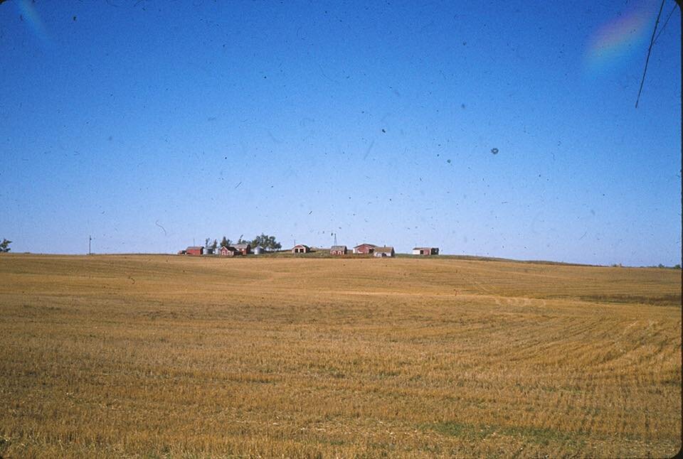
I think today’s photo was taken at Pattison State Park, though I’m not sure.

Lou Ann and I arrived in Carlton WI next and then Cloquet where we a TV report with Channel 10 Duluth’s Rob Womack. We spent a night with Keith and Bobye Bing as the Duluth Shriner’s Convention had taken all of Cloquet’s motel rooms. After the TV filming it was 11:30 a.m. till we could start walking again and we managed 9 miles down RR tracks before evening to get out of town. We camped withIn hearing distance of both the railroad and the St Louis River.
After not writing in my journal for a few days, I next reported we spent a night in Floodwood MN at a motel after finally getting off the RR tracks. I wrote “They’re so hard to walk on that I can only take a little of them at a time.”
Once again we found ourselves with no way through an extraordinarily swampy section there. Everyone we talked with said we’d be crazy to try it, so we didn’t. We ended up at a campground on the west bank of the Mississippi River near Jacobson and spent the rest of the day locked in misery in our tent because the mosquitos were too bad to be outside. I couldn’t take a breath without sniffing them in.

After an uneventful night camping illegally in the cemetery Lou Ann and I struck out for the town of Longville MN. Longville had a winter time population of 171 but many more in the summer. Many expensive resort homes were built on Leech Lake and in the woods around the area. Anyway, we got into “town,” which was just one block of shops. There weren’t streets & homes in town as the population was all spread around the lake & elsewhere.
We stayed at Austin’s Campground where there weren’t many overnighters. It was mostly summer seasonal permanent trailers of retired folks.
Our nest stop was to be Akeley, but we found the lone motel was booked full for the Labor Day weekend. So we decided to stay at the campground rather than go to Akeley.
On one day there we met 2 rangers who showed us where the NCT in Chippewa Forest will go. Spent the whole day with them talking about trails, seeing the new NCT and hiking around. I remarked that I saw an osprey.

Lou Ann and I camped at a glorious spot a few nights later. We were on a narrow spit of land between Diamond and Blue Bill Lakes. By 2 pm we’d hiked 11 miles and then took a side trail to the lakes several miles further to a spot that ranger Gil Morris showed us. We met 4 horsemen along the way and stopped to chat with the riders for a bit.
I mentioned that the mosquitos were a problem this day, and I was glad I bought a mosquito netting in Longville. It was also hot and near 90°F.
When we set camp on our spit of land Blue Bill Lake, long & narrow, was to my right, surrounded by pine and aspen. At the shoreline Minnesota wild rice grew several feet into the water. To my untrained eye the rice looked good and green, but we were told the summer was too wet, and the crop was poor. To the left, Diamond Lake, acres larger, curved around and nearly touched Blue Bill. The two lakes are connected by a stream, then nearly dry.
The lakes were filled with millions of inchlings. A bald eagle was said to be working these lakes but in those years not long after the DDT ban, the birds were very rare and we didn’t see it.


Arrived at Douglas Lodge in Itasca S.P. On September 7, 1978. Because we’re here ahead of schedule we decided to stay a second night as well. The lodge, built in 1905, is two-storied, log. It has a rustic-elegant dining room, screened-in porch, fireplace, etc. All the accourtrements of elegance. All for $5 a night a piece. Our room is a corner one, with 2 windows, a double bed, dresser, chair. After settling in I joined Lou Ann who was reading in the common room. The lodge looks over Lake Itasca where I got some great photos. Thursday night we were practically the only ones here. Ate luxuriously & expensively in the dining room. And was well worth it. This place Reminds me in mood of the Airdwood back in NY. I know I enjoyed the day off.


Lou Ann and I were still at Lake Itasca on September 9,1978. We left as planned, but the bugs were so bad we abandoned our trek after about an hour and then returned to Lake Itasca. We decided to leave again the next day but in the end we decided not to hike this section. Instead we’ll get out by Park Rapids for points west.
We really hit it unlucky. If there had been a frost the bugs would be gone, which is typical for this time of year,
And we could have been able to hike. Who ever heard of mosquitos and 97° weather on Sept. 9? I wrote in my journal how disappointed I was we weren’t able to hike this section. We were pretty unlucky with weather generally this year—late snow, much rain, extreme cold. Now the hot weather and bugs are forcing us to reroute when we never had to before for weather or anything else. It’s one thing to ride around a bad section we can’t walk through, it’s another bypass a section of good walking because the mosquitos, even with headnets and repellant, were making us crazy. I never thought insects could be that bad but I believed it now.
Part of me says we made the intelligent decision, but it was still disappointing and made me wonder if we were taking the easy way out. Were we giving up too easily? How did the Native Americans handle the bugs? I don’t know. Perhaps I never will.
I only know there were more questions than answers to this one.


Lou Ann and I arrived in Park Rapids MN on September 10, 1978. Rice Park campground seemed like an ideal place for us to stay. The campground was in town and near stores and a laundromat and it was free. It had picnic tables and a hand water pump, lacking only a shower for it to be perfect.
When we arrived no one else was camping there. We were glad of that as it meant we wouldn’t have to put up with campground partying noises. So on September 11 we did our laundry and shopped for paperback books, got some fresh baked bread and few supplies. That evening, as the sky was clouding up, our stove broke, and we were forced to eat a cold dinner. I soon retreated to the tent because the coming storm was making the mosquitos swarm.
By 10 p.m. when LouAnn came to bed, the storm had begun. First, we heard the rumble of thunder, then a few raindrops on the tent fly. We saw flashes of lightning brighten the clouds suddenly, and the storm was close enough that it almost seemed the flashes were in our eyes and not an act of nature. The storm skirted us for a while, and I thought the worst of it might pass by. But then the wind picked up, the rain fell out of the skies and the thunder crashed on top of us. The thunder and lightning didn’t stay above our heads for long. It faded away so that we knew we weren’t in danger from it. But the lightning still brightened the night crazily.
The rain got worse amd came down nearly as hard as the night near Carlton when 6” was dumped on us. About midnight there were voices. (LouAnn later told me this; I was asleep). She heard a car above us on the embankment, then nothing.
Suspicious, she leaned out of the tent, getting her hair wet in the rain.
“Carolyn,” she shook me awake. “Look outside and make me a liar. Tell me our packs are still there.”
“What?”
“Our packs are gone.”
I leaned out and looked at the picnic table sheltered by a cupola where we had covered our packs.
“Holy s**t,” I said. “They’re not there.”
More tomorrow…
As soon as Lou Ann and I discovered our packs were gone, we got up, got dressed and immediately ran 2 blocks up the street to a motel. We routed the owner out of bed and called the police.
By now we were soaked and wide awake. It was raining as hard as ever. LouAnn didn’t have a raincoat. I had no socks. The rain was inches deep in the motel parking lot.
The local Police arrived and we told them the whole story. Later, LouAnn decided she didn’t want to return to the tent to sleep. She feared a return of the thieves, particularly when they realized all they got was food and clothes. We bundled up our remaining property, only to discover the nearby motels were filled.
Then we called the police again, explained our situation and ended up spending the night in the sheriff’s office. We filled out an itemized list and approximate cost of the items. The total was about $800 between the two of us.
We downed a lot of very strong coffees and talked with Mel the dispatcher. He was 60, a vet of WWII who spent 5 brutal months as a POW in Germany. He and LouAnn talked most of the night. I fell asleep in the backroom listening to them talk though
I was awake for a long time.
Of all the things we had lost, what distressed me the most was losing a single sheet of paper that bore the names and addresses of everyone along the way who had been nice to us. The list was irreplaceable; we didn’t have another copy. We planned to write everyone, thank them again and let them know we had made to North Dakota. All I could think of was that one lousy sheet of paper that was valuable only to us and which our thieves were certain to discard.
The rest of my $280 loss was immaterial. My clothes and knife, could all be replaced. Some things—a book about Itasca park—could not be, but all I really cared about were those names and addresses.
LouAnn lost her camera, 2 pairs of eyeglasses and the stove. Her loss came to over $500. She was most upset about her 5 weeks of journal that was lost.
Once the sun came up, we left the sheriff’s office, had breakfast and went to the Park Rapids Enterprise newspaper to tell them our tale of woe. Later, we stopped at a drug store and bought a few personal items. Then, shortly after lunch, we checked into a motel to relax and catch up on our sleep.
On the 12th, just as we were preparing to go to lunch with a reporter from another newspaper, the police recovered the packs more or less intact & the culprits confessed. They had seen the story in the local newspaper the day before. And I believe the police went to their place to question them, as local police always know who the local miscreants are.

Once Lou Ann and I got out of the north woods, we were in prairie lands. It was about September 18, 1978. We saw fields of sunflowers, sugar beets and potatoes where the earth was as flat as the Flat Earth Society would have us believe. Also, I saw very few trees. We were really out of the woods now in more ways than one.
We spent the night of September 21 In Colfax ND (pop70). We hiked about 13 miles along the Railroad tracks from Dwight ND. We only hiked about six miles the day before because LouAnn’s cold was bad so we didn’t go further. Saw a marsh hawk (now called harrier). I was amazed at the sunflower fields. Extraordinary farm land. Last night stayed in Rev. Nyhusdmed’s (Ny-hus-mon) church and September 22 sleeping behind the church in Colfax. Weather clear, cool nearly perfect backpacking weather. The day was clear and we expected our first frost that night.


September 23, 1978 was one of the best single days of Lou Ann’s and my trip. Perhaps it was all the more special because we had no idea when we started hiking that morning that the day would be as it was. We left late in the morning—about 10:15 a.m.
Before we got out of town we ran into a deputy sheriff who was trying to track us down. Seems Channel 11 was looking for us. The deputy decided to help us find a campsite up the Sheyenne River road that afternoon. We ran into him after we’d hiked several more hours and he said he wanted to take us to meet “Good Night Irene,” a local character who ran a kitchen band and wrote a column for several local papers. She had also been on the “Today” show.
Anyway, we got to her house and she proceeded to take us on the “Grand Tour” of this spectacular area of North Dakota.
The river valley is in a huge basin. On either side are hills that look like drapery folds. The hills are sandy-colored grass. With Irene we visited her “park,” her “Pike’s Peak” and her parents. There we were treated to a “fiddle tune” with Irene on the piano and her 75-year-old father on the fiddle. It was real foot-stomping, honkytonk music. Also had some sandy-colored watermelon and marble cake.
More about this day tomorrow

After Lou Ann and were fed and serenaded by “Good Night Irene,” she gathered us up and took us out again to visit a “petrified spring,” a vista overlooking the valley, the plum trees and Irene’s daughter’s house that she was redoing herself. Eventually, we headed toward Ft. Ransom where we met Snorey Thorfinnison, the local historian and author of several books and songs about Ft. Ransom some of the prehistoric Native and Viking sights.
Snorey explained to us about the fort (1867-1872) and the local Native mounds, writing rock monuments, etc. They arranged for us to Now stay for 2 nights in a dormitory with YACC workers (Young Adult Conservation Corps) who are building facilities at a new state park. They have the whole house so it was a great place to stay.
We really got the full tour!


Lou Ann and I stayed in Valley City ND for two nights, handling our usual “town” business of laundry, food resupply, getting mail, etc. We had dinner with the reporter who did a story about us and spent a nice evening chatting, eating and getting acquainted. We left the morning of September 28, 1978, walking again along the Sheyenne River. Unfortunately, the gravel road we’d enjoyed walking on for a few days before soon turned into a paved road.
We camped at Baldhill Park on Baldhill dam on the south end of Lake Astabula, about 11 miles out of Valley City. Here on the lake we saw a red-breasted nuthatch and assorted gulls on the water. At this point in my life my gull ID ability was pretty much limited to knowing they were gulls but not what kind.
The valley in this area was wide, with not as many trees, and I dubbed it as “not quite as scenic as further south.”


On September 30, 1978 Lou Ann and I left Wesley Acres Camp and again headed north. After only a few miles we ran into members of the Wieland family. They invited us to breakfast even though we’d already eaten. Naturally, we didn’t refuse. We were the main topic of conversation in the family of 13 children. The family was German; great-grandma, a spritely 89, was born in the old country. In the course of our conversation we learned of Sister Joanna, one of the 13 children who was now a nun. The mother, Matilda Wieland, gave us a note which she told us to give to Sister Joanna. Mrs. Wieland is sure Sister Joanna will put us up in a 5-nun group home in Harvey ND, our last mail stop.
Also, the Wielands arranged for us to stay with the Pickers, who live in Karnak (population 9 with a 10th on the way—that’s progress!). We camped in their backyard on October 1. That evening the Pickers took us to Hannaford, a small town where the American Legion was having a fund-raising supper of ham sandwich, scalloped potatoes, baked beans and French apple pie. Then we hiked out of Karnak to get to Cooperstown ND. We didn’t get out of town until late because we had grocery shopping and an interview to do.
At this point in the hike, we were both finding it tough. Every night we’re dependent on the good humor of a farmer who’ll let us sleep and camp somewhere on their property. We’re also dependent on them for water. Plus, we need to be at our perky best in order to convince someone to let us camp. I’m starting to feel like a beggar, always begging for water or a place to set the tent. It’s getting to be a drag. One can only see so many section roads and newly plowed fields. I sure liked hiking in the woods a lot better. And I’m really tired of having to beg for a camp site


On October 4, 1978 I reported that Lou Ann and I were in Carrington ND. And we weren’t even supposed to be there at all. After we left Cooperstown we kept getting frightening reports from nearby residents about the Native reservation we were to walk through. I don’t know if those reports reflected local prejudice or reality, and since we knew nothing about the area, neither did we.
So we headed west instead, catching a ride with a woman who let us stay with her and her family on their farm outside of town.
The next day we reached Harvey ND and the convent of the Sisters of Mary of the Presentation. It was a bitter cold day, and I was nearly frozen by the time we got to the convent. At this point in our trip we only had lighter weight clothing, as the heavy winter gear from the start of our trip had long been sent home.
Once at the convent we found Sister Joanne, the Wieland’s daughter, had already been transferred so we never got to meet her. However, the other sisters were still glad to take us in. The sisters, mostly in their 50’s and 60’s, were charming and sweet ladies who were as quiet as mice, never raising their voices & nearly always smiling. They fed us divinely. I remember a crabapple jam that was as sweet as morning sun. Staying with the sisters was a quiet luxury that we both enjoyed.

Lou And and I spent the night of October 5, 1978, in a ghost town. Lincoln Valley was recently abandoned and which once had over 20 homes (so we learned later). We camped behind a church, as ever low on water. We were amazed and thrilled at the beauty of ND with its rolling hills and wide valleys. After hiking 6 ½ miles a woman and her children stopped their pickup to chat. She took us over to her house and across Sheyenne Lake. She was interested in our trip and we had a nice chat. After leaving her place we walked another 3 ½ miles to reach our ghost town. Here we found an old store with an assortment of rusty tin advertising signs behind it. It was actually a decent place to camp as it was private and away from the farm fields. It didn’t have water but we’d gotten water from the lady in the pickup.

Lou Ann and I were in McClusky ND on October 8, 1978, after surviving unscathed the night in the ghost town of Lincoln Valley. We left what’s left of Lincoln Valley on October 6 and headed west amid the concern of a local resident who was afraid we were stranded motorists. We kept walking after confirming we were not stranded, but we were now nearly out of water. We finally found a farmhouse where a German Shephard grabbed my pant leg. We also got what I called the worst tasting water of the trip. It was sulfer water, and I don’t know how the farmer stood it.
Later, at lunch we stopped at a canal built in a Garrison Dam project. In McClusky were were interviewed by an idiot from a local paper—he never bothered to tell us which one. And I really didn’t care to hear about his latest camping trip.
We stayed in a motel that night and watched the miniseries, Centennial. It was funny to see the Ohio River and to be told it’s “old St. Louis.” It was also funny to see the “doctor’s” house where one character had an arrow removed and know it was the house across from where we ate lunch. At the time we wondered if that was indeed the house where the filming would be done.


Lou Ann and I left Pick City ND October 11, 1978 and after walking along a busy highway for a while, we concluded the hiking situation was hopeless. So we caught a ride with a passing trucker to reach Killdeer ND, the next spot where it looked that we might find some walking.
We spent the night near Killdeer and talked with locals about what we might find ahead of us. Then we headed toward Little Missouri Primitive Park.
We met a North Dakota cowboy who had a skinned out coyote in the back of his pickup. He lived right at Little Missouri on a 2000 acre spread that he said was almost “too small.”
When we reached the Little Missouri Badlands, I was a loss for words. This land is spectacular! We camped on a bluff overlooking the Badlands. We walked along the bluffs and down into the canyon along the many trails there. We found hard clay soil, cactus and succulents but little else in the way of vegetation. Brown earth covered everywhere. On one of the seemingly inaccessible bluffs we saw three, maybe four Herefords, and wondered where they came from or how they got there.
The night was another cold one. We had sleet, a heavy frost, some wind. After dark we heard the coyotes singing and then their morning song about 3 a.m. More cold weather ahead with only a few days left to go to the end of the trail. It was too late in this game to get our winter gear back, and we were worried that the clothing and gear we have going to keep us warm enough for these last days of hiking.


Lou Ann and I arrived at Four Bears Park Oct. 13, 1978, the official end of our hike. We had to get a ride most of the way from Little Missouri. We were afraid it would snow, it was so cold & bitter.
We got a ride in the back of a pickup—it was freezing—with three Natives, who warned us it would not be safe to hike where we were planning to on a Saturday evening. We told them we were low on water so we stopped at a flowing well in the field, entering by a stile that kept animals out. There I lost the walking stick I’d carried with me the entire trip. It was actually a repurposed cross-country ski pole, as they didn’t have trekking poles then. Such is life. When we first stopped I thought that was end of our ride, so I started unloading the pack and everything else. In the confusion I left my stick.
The drive through the Native reservation and the Badlands was breathtaking. It reminded a bit of those western movies that are filmed in Monument Valley. Lots of clay, sandstone, buttes, mesas, cactus, eroded soil and cold. We crossed back into Central from Mountain time. The second ride was from a Native who took us within 5 miles of Four Bears and then dropped us off. He pointed out 2 open cabins where he said we could stay. He was a cattleman and traveled with 2 blue heeler dogs.
The park at 4 Bears wasn’t much but there was a motor lodge and despite the expense ( $22/night!), we stayed.
Next: we celebrate!