Day Hiking + Backpacking: Our Go-To Trails in the Allegheny National Forest
With over 200 miles of hiking trails, the Allegheny National Forest (ANF) offers some of nature's best therapy, always helping to shake off the winter rust. These are a few of our "go-to" trails, whether day hiking or backpacking, both beginner and experienced. Need a map? Find 'em in our online shop.
Please remember - although close to our small towns, the Allegheny National Forest, at 517,000 acres, is vast and wild. Should you find yourself in an emergency situation on the trail, cell phone reception is very limited at best, often times nonexistent. Plan ahead. Let someone know where you're going and when you plan to return. Know the ability and skill level of those you're going with and don't overdo it. Always take a map. Although there is trail map signage, we've had experiences where maps were damaged by critters making them tough to read. Carry a day pack, even if you're only planning a short hike. It should include water, snacks, an extra layer of clothing, first aid kit and headlamp at the bare minimum. And please, please respect the trail. We love our forest. Pack it in, pack it out.
Morrison Trail
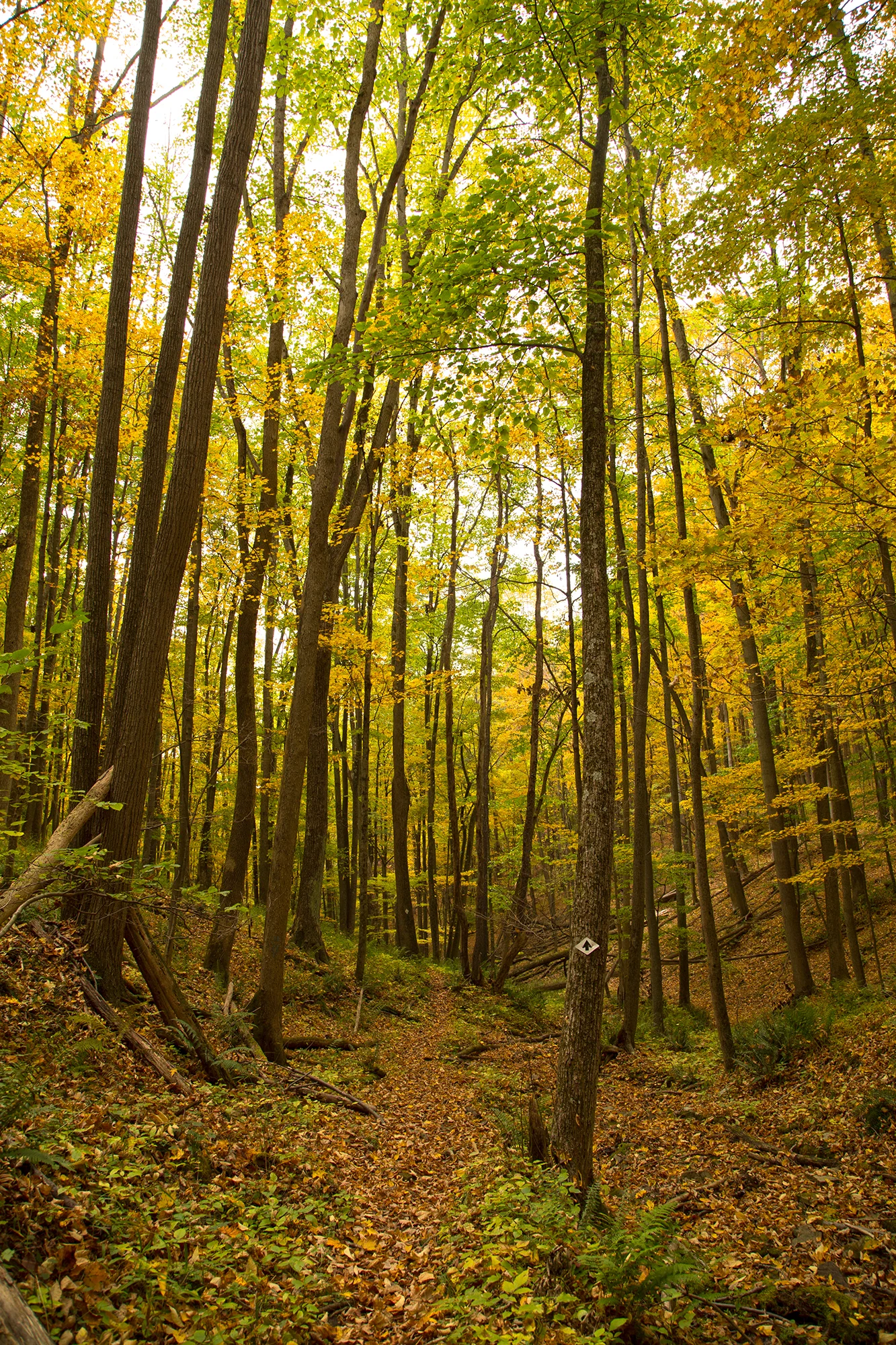
Morrison Trail is hands-down one of our favorite hikes in the Allegheny National Forest, regardless of season. During winter months you'll find yourself weaving through green patches of mountain laurel in 6" of snow. Spring brings the sound of tiny runoff streams in all directions and makes for interesting (and fun!) creek crossings. Ferns start to pop, and before we know it the forest floor is covered in a brilliant, lush, sea of green.
If you're not familiar, Morrison is an 11.4 mile loop trail (divided by a 1.3 mile cross connector) making it an excellent choice for 2-3 day backpacking trips. I took my first solo backpacking trip here years ago, and have since taken my kids backpacking here numerous times. It's also an excellent out-and-back day hike. The trail is well marked and can be moderately difficult with a few stream crossings and an elevation change of roughly 600'. Wildlife is abundant on this trail. We've seen deer and fox, and been visited by coyotes during the night while out for a few days. The trail can get busy on weekends during summer, but I will add that we've hiked this trail with 15 cars in the parking lot and only saw a couple people on our hike. If you're planning a backpacking trip and have the option to go on weekdays - take it, you'll most likely have the place to yourself.
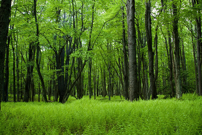
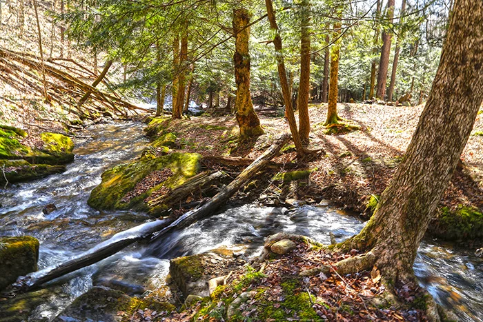
Day hike: Morrison offers something for everyone. The first half-mile is a well groomed pebble path for those that aren't looking for something strenuous but want a change of scenery and a quick connection to nature. After the first half-mile the trail turns into the beaten path, twisting and winding down to Morrison Run and eventually Kinzua Lake. We often spend the day hiking a couple miles in to explore around the creek and hike back out. (Pictured below.)
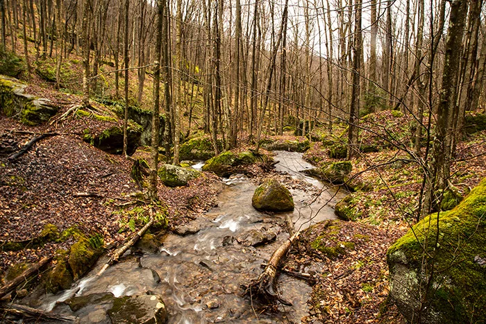
Backpacking: Morrison has become our kids favorite place to go backpacking. But we started small. If this is your first time out and you're not quite ready to tackle the whole trail, there are a couple established camping spots in the first few miles near where the trail crosses Morrison Run (pictured below). This area boasts small waterfalls in every direction and numerous big rock outcroppings and boulders, some setting upon each other creating cool little caves. On the flip side, if you're up for a good challenge, the entire 11.4 mile loop won't disappoint!
Useful info if you plan to check out Morrison trail: Morrison trailhead is located on State Route 59, about 18 miles east of Warren, PA. Facilities at the trailhead include ample parking, vault restroom and informational signage. No fees or permits are required for this trail. Trail leads to Morrison Campground, a primitive area of 38 boat/hiking access campsites, which have picnic tables, fire rings and vault toilets. Morrison campground no longer has pump water. Dispersed camping is permitted along the trail. Campfires are permitted in a fire ring only. If you choose to camp along the trail and are not within the boundary of Morrison Campground, a Forest Order requires that camps be set up a minimum of 1500 feet from the timber line of the reservoir. Please practice Leave No Trace - Pack It In, Pack It Out. Plan ahead - let someone know where you plan to hike and when you plan to return. There is no cell phone reception in this area.


Tanbark Trail
Tanbark is an 8.8 mile trail that traces the route used to skid timber during the turn-of-the-century tanning industry, which used hemlock bark as a source for curing leather. It's not a loop trail, so shuttling a vehicle (or an out-and-back hike) will be necessary. (We also offer vehicle shuttles.) It can also be used as part of an extended trip by tying into Hickory Creek Wilderness, the North Country National Scenic Trail (NCT), or Minister Creek. It's well blazed (white blazes) and established, and boasts impressive boulders, rock outcrops, and scenic streams. Over the years we've crossed paths with deer, fox and the occasional coyote while hiking Tanbark.
We may be a little biased having lived two miles from the trailhead for the last ten years, but Tanbark often times feels like the Allegheny National Forests best kept secret. We've hiked it hundreds of times and have only seen a handful of people while doing so. When folks ask us where they should day hike or backpack that's semi-close to town but will still feel like they've gotten away from it all, this is the trail we recommend.
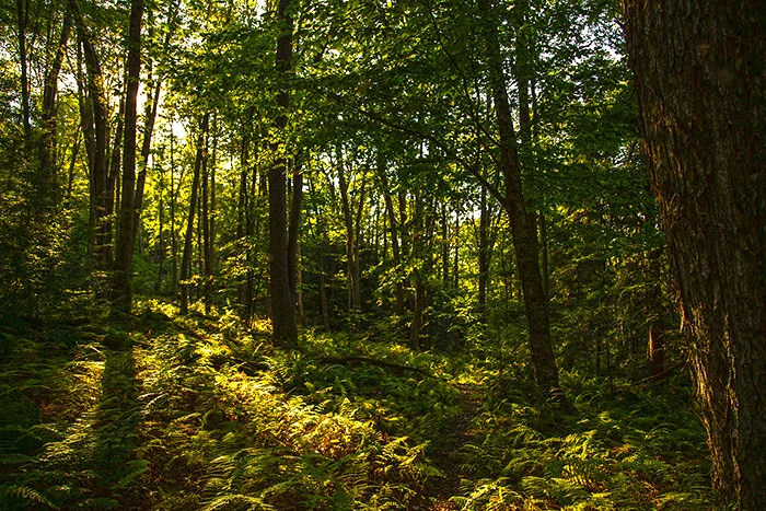
Day Hike: If you're looking for a nice, easy hike we recommend the option of starting at Route 337 (depicted on the map as State Route 3005) and heading north toward US 62. You'll find level to rolling terrain with little elevation change. After patches of mountain laurel and crossing over Slater Run, the forest opens up and you're surrounded by an amazing sea of ferns under the towering canopy.
Backpacking: Tackling this 8.8 mile trail on a two or three-day backpacking trip is an excellent choice. Starting at the trailhead on US 62, it takes you alongside Boardinghouse Run, a beautiful creek with moss-covered boulders, cascades, and hemlocks. The most difficult terrain is found at this end, where the trail climbs roughly 800 feet over the first half mile. (We used this section of Tanbark for our training hikes leading up to our backpacking trip in the Grand Tetons last October.) Once the trail levels out, you'll find rolling and level terrain along the top of the plateau. From this point, ascents and descents reach 200 vertical feet where the trail crosses stream valleys and glens. The trail offers a couple nice (established) campsites before crossing Route 337 (roughly mile 3) and another between the Route 337 and Route 2002 crossing. Before reaching Route 2002 you'll come upon large rock formations, eventually taking you under and through large slabs of rock where you'll "thread the needle" through these ancient formations. Crossing Route 2002 leads you to Hearts Content Recreation Area and eventually Dunham Siding and the NCT.
Useful info if you plan to check out Tanbark trail: Trailhead is found on US 62 between Warren and Tidioute, and has no facilities. Two roadside pull-offs make up the parking area. No fees or permits are required for this trail. From US 62, this trail leads to Hearts Content Recreation Area, which has 26 family campsites and a large group area with picnic tables, fire rings and tent pads. Two campsites have lean-to shelters and charcoal grills. Vault toilets and pressurized water are also available. First come, first serve campsites are available. No reservations are accepted. Dispersed camping is permitted along the trail. Campfires are permitted in a fire ring only. Please practice Leave No Trace - Pack It In, Pack It Out. Plan ahead - let someone know where you plan to hike and when you plan to return. There is very limited cell phone reception in this area, with the only reception (Verizon) being near the trailhead at US 62.


Tracy Ridge, Johnnycake & North Country Trail
The proposed Tracy Ridge Wilderness Area trail system is a bit more complex than Morrison and Tanbark, and much more remote. It's the closest thing to backcountry we've found in Pennsylvania... especially when you get out there in its nooks and crannies. Not only do you get the lush green of the forest, it also boasts some stunning views of Kinzua Lake and numerous small creeks that flow into it.
This trail system offers a smorgasbord of day hiking and backpacking options. Combined with the NCT and Johnnycake Trail, it includes various loops, connector trails, and spur trails that make up a complex 33.68-mile system. Always take a map on this trail. Depending on your route, the terrain is often level or rolling, but several ascents and descents range from 100 to 700 vertical feet and can be steep. Trails often follow narrow hillsides on steep embankments along streams and Kinzua Lake.
Camping options are just as plentiful with Hopewell and Handsome Lake campgrounds (boat/hike-in only shoreline campsites with picnic tables and fire rings, vault toilets, pump water and self-service pay station; $12/day). If you plan on staying at these campgrounds and have the option, a weekday stay is recommended, especially in July and August, as campsites fill up quickly by boaters. There are excellent dispersed campsites along the NCT as well.
We've seen deer, fox and raccoon from the trail, and been visited by coyotes while camping. Bear scat and prints cross our path occasionally, but surprisingly, we've never seen a bear on this trail.
Useful info if you plan to check out this trail: Tracy Ridge is located off of State Route 321 north of the junction of State Route 59 and south of the junction with State Route 346. Facilities include: 119 spacious family campsites with picnic tables, fire rings and tent pads, vault toilets, hand pumps and a trailer dump station. Group sites (entire camp loop) are available. Campsite reservations are accepted (1-877-444-NRRS, or the website). First come, first serve sites are also available. Please practice Leave No Trace - Pack It In, Pack It Out. Plan ahead - let someone know where you plan to hike and when you plan to return. There is no cell phone reception in this area.