Allegheny National Forest Hiking Trails
With over 200 miles of hiking trails, the Allegheny National Forest (ANF) offers some of nature's best therapy.
Please remember - although close to our small towns, the Allegheny National Forest, at 517,000 acres, is vast and wild. Should you find yourself in an emergency situation on the trail, cell phone reception is very limited at best, often times nonexistent. Plan ahead. Let someone know where you're going and when you plan to return. Know the ability and skill level of those you're going with and don't overdo it. Always take a map. Although there is trail map signage, we've had experiences where maps were damaged by critters making them tough to read. Carry a day pack, even if you're only planning a short hike. It should include water, snacks, an extra layer of clothing, first aid kit and headlamp at the bare minimum. And please, please respect the trail. We love our forest. Pack it in, pack it out.
Need a map? Find 'em in our online shop. We also offer high quality backpacking gear rentals, backpacker shuttles and sell backpacking/camping gear both online and at our brick and mortar store in downtown Warren. Not sure which trail to tackle? Contact us for help!
Anders Run Natural Area (Cornplanter State Forest)


The Anders Run Natural area is only 96 acres, but it contains many old-growth white pines, some over 4 feet DBH. (Note: the term "diameter at breast height" or DBH is used by foresters to define tree size, along with height. DBH is the tree diameter measured about four feet off the ground.) Like other accessible timber stands in the upper Allegheny River watershed, the original forest cover was logged sometime in the first two decades of the 1800s. Growth ring counts of wind-thrown trees indicated an age between 200 and 225 years. There is a walking trail system almost two miles long through the area. There is a native trout stream and several fine stands of wildlfowers. There is an historic residence on the property built in 1841, known as the "Little Stone House." One of our favorite hikes when we're in a time crunch due to its proximity to Warren.
Fees: No fee
Permit Info: No permit required
Water: None
Restroom: None
Beanfields
This 120-acre grassland is one of our favorite short hikes when we're in a time crunch due to its close proximity to town. It boasts a nice, easy, flat hike following alongside Brokenstraw Creek, giving views of Crulls Island, one of seven federally-designated Wilderness Islands along the Allegheny River.
Fees: No fee
Permit Info: No permit required
Water: None
Restroom: None
Beaver Meadows Trail
This system consists of five interconnecting trails, totaling 7.1 miles that wind through the forested hills around Beaver Meadows Lake. This trail begins at Beaver Meadows Recreation Area. The terrain around the lake is gentle, offering a leisurely hike. Opportunities to view wildlife are plentiful.
Beaver Meadows Loop - This 3.0 mile loop is marked with off-white diamonds. South of the lake, the trail passes through a grassy savannah dotted with spruce and pine trees. As the trail nears the headwaters of the lake, look for the small fenced areas that protect blueberry plants from deer browsing. The trail then passes over the lake on a floating boardwalk. North of the lake, the trail climbs to a forest of black cherry and red maple.
Seldom Seen Trail - This trail is 1.2 miles long and is marked with blue diamonds. It passes through a mature forest of black cherry, red maple, beech and red pine. The highlight of the trail is the half-acre blueberry patch. The area is fenced to protect the plants from deer browsing. Enjoy the blueberries in late July and August.
Salmon Creek Loop - This loop trail is 1.3 miles long, and is marked with blue diamonds. It is dominated by a peaceful red pine and spruce forest. Several beavers make their home in Salmon Creek. If you are quiet, you may be able to see one.
Penoke Path - This trail is 1.1 miles long and is marked with blue diamonds. As it follows Penoke Run, it passes through a grassy savannah on an old railroad grade. The large old stumps in the savannah are the remnants of a forest that was cut at the turn of the century.
Lakeside Loop - This short 0.5 mile trail is marked with blue diamonds. It takes you closer to the lake to enjoy the scenery, view wildlife, or fish.
Find the US Forest Service brochure here.
Fees: No fee
Permit Info: No permit required
Water: None
Restroom: Vault restrooms available.
Bent Run Waterfall Trail

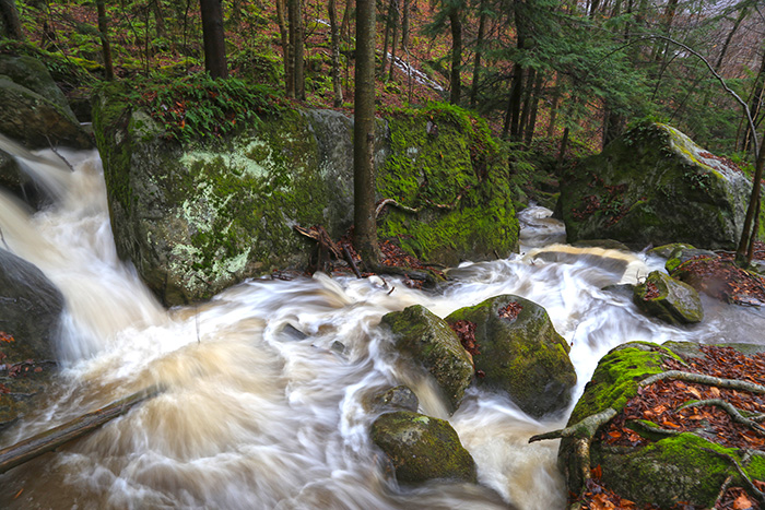

Bent Run Waterfall is a 2.9 mile moderately trafficked out-and-back trail just past Kinzua Dam (coming from Warren) on Route 59. This little trail follows the stream up roughly 300' with waterfalls flowing over large rock formations in all directions. The largest waterfall is about 30 feet, when the stream is at capacity.The first half mile of trail branches off into multiple footpaths giving visitors a plethora of fantastic views. The trail itself is hard to find and follow after the first half mile, but is fun to explore around the nooks and crannies of rock cascades.
Fees: No fee
Permit Info: No permit required
Water: None
Restroom: None
Brush Hollow Trail
The trail is 5.6 miles and is marked with gray diamonds. The trail starts at the Brush Hollow Trail and ends at the Twin Lakes Trail near Twin Lakes Recreation Area.
The Twin Lakes Trail connects Twin Lakes Recreation Area with the North Country National Scenic Trail. Using this network of trails can take backpackers all across the Allegheny National Forest. The trail is best suited to hikers, although it is open to skiing and mountain biking. The Mill Creek Trail parallels Big Mill Creek, a popular trout stream.
Find the US Forest Service brochure here.
Due to recent storms this trail is temporarily closed.
Fees: No fee
Permit Info: No permit required
Water: None
Restroom: Vault restrooms available.
Restrictions: Hiking, cross-country skiing, mountain biking and fishing are permitted.
Bullis Hollow Trail
The new trail is 8.3 miles in length. The Bullis Hollow Trail, a single-track, non-motorized trail crosses through the northeastern section of the Allegheny National Forest known as Chestnut Ridge. Trailheads are located just north of the Tracy Ridge Campground within the Allegheny National Forest along Rt. 321 and along Forest Service Road 173. With the opening of this trail, new hiking connections are made between the existing Tracy Ridge Trail System with 38-miles of interconnecting hiking trail loops through the federally designated Allegheny National Recreation Area and the North Country National Scenic Trail (NCNST).
Fees: No fee
Permit Info: No permit required
Water: None
Restroom: Vault restrooms available at Tracy Ridge campground.
Buzzard Swamp Trail
Buzzard Swamp. A 11.2 mile system of inter-connecting trails offers some of the best wildlife viewing opportunities on the Forest. The area is an important link in the Atlantic flyway during the waterfowl migration.
Visitors can cross-country ski, mountain bike, hike, hunt or go bass fishing. Fifteen man-made ponds were constructed in the early 1960’s in partnership with the Pennsylvania Game Commission. Buzzard Swamp is within a special management area that emphasizes wildlife management and recreational opportunities.
Two trailheads provide access to the area. The Songbird Sojourn Interpretive Trail is a 1.5 mile self-guided nature trail that starts at the Buzzard Swamp 157 trailhead. The trail is partially marked with gray diamonds. Most of the trails are not marked with diamonds, so watch the informational signs for directions. The skill level of the trails is easy and the terrain is relatively flat. Some of the trails are located within meadows with little protection from the sun and wind. Be prepared. “You Are Here” signs are located at trail junctions and other key locations.
Find the US Forest Service brochure here.
Fees: No fee
Permit Info: No permit required
Water: None
Restroom: Vault restrooms available at Songbird Sojourn Interpretive Trail.
Restrictions: Hiking, cross-country skiing, mountain biking, hunting and fishing are permitted.
Heart's Content Recreation Area Trails


While most of the region's forests were mostly clear-cut in the 1800's, 20 acres of what is now Hearts Content was owned and untouched by Wheeler and Dusenbury Lumber Company from 1897 to 1922. Wheeler and Dusenbury deeded the land to the U.S. Forest Service in 1923. In 1934, the Chief of the Forest Service recognized the old-growth stand and 102 acres of surrounding land as a National Scenic Area. Hearts Content became a National Natural Landmark in 1973.
Hearts Content Interpretive Trail is a short 1.1 mile loop trail through the Old-Growth Forest, boasting 300+ year old white pine, hemlock and beech forest. Along the way find out what effects time, weather, insects, diseases, and deer have had on the look and feel of this old growth stand. A picnic area with pavilion is also available near the trailhead.
Tom's Run Loop, a 3.2-mile hiking and cross-country ski trail, has a red pine stand that puts on a great display of colors on the towering trees at sunset. (If you're not up for the whole 3.2-mile hike but want to check out the red pine stand, simply hike Tom's Run trail backwards.)
Ironwood Loop - 3.3 mile hiking and cross-country ski trail
Wheeler Loop - 1.3 mile hiking and cross-country ski trail (located west of the trailhead and encircling Hearts Content Campground.
Orienteering Trail - 5.9 miles (a competitive sport that involves using a map and compass to find your way in unfamiliar terrain) can also be accessed from this trailhead. There are three orienteering courses to select from:
Introductory - controls 1 - 10 are designed for easy hiking (all on trails), easy navigation;
Intermediate - controls 21 - 26 are designed to be easy hiking (mostly on trails) but more difficult navigation;
Advanced - controls 31 - 35 are designed for off-trail hiking and very difficult navigation.
Find the Orienteering brochure here.
The trailhead is plowed during winter activity season - generally between December 20 and April 1.
Find the US Forest Service brochure here.
Fees: No fee
Permit Info: No permit required
Water: Yes
Restroom: Vault restrooms available.
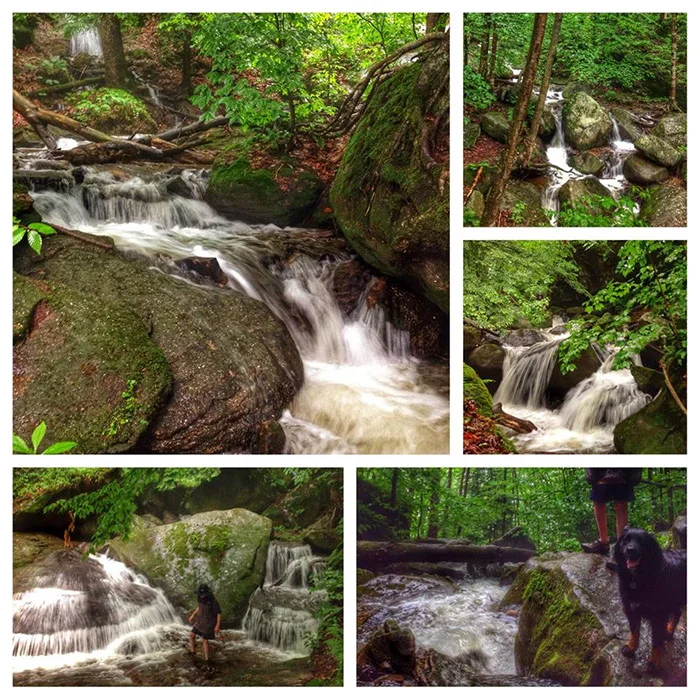
Hector Falls
The first time we stumbled upon Hector Falls was an early morning hike after a couple days of rain. The forest had a dense ground fog making every leaf a brilliant green from the moisture. It's an odd place, coming off as a normal little creek and trail, until it drops 22 feet over a giant block of sandstone, towering trees hanging over the rocks edges. It's a great place to pack a lunch and have a picnic, but don't forget bug spray. Our favorite time to hike this trail is early morning during summer, or anytime during spring and fall.
It's created when Hector Run drops over a 22-foot tall by 10-foot wide square block of sandstone. Blocks that have already been cleaved away from the falls area lie jumbled along the shallow flank of the Tionesta Valley. These blocks of conglomerate form a rock city, which is a periglacial feature, or a feature not directly formed by the grinding power of a glacier. As far north as Hector Falls is, the glaciers of the last ice age didn’t make it this far, with the glacial front stopping north of Warren. The region along this glacial margin resembled the arctic tundra and was subject to a great deal of freeze-thaw temperature swings. The action of frost wedging split off these immense blocks of stone, which were then slowly dragged downslope by soil creep.
Hector Falls does not have official signage, and is out there a bit, so it's best to have these directions with you: From Warren go East on Rt. 6 to Ludlow (17 miles). Turn right onto South Hillside Avenue (also called South Hillside Road). At the T make a left onto Water Street, then your next right onto Scenic Drive. Cross the railroad tracks and follow FR 133 for 1 mile. Turn right onto FR 258 and go 2.1 miles until you reach gated FR 258H on your left. Park at the gate. (41'41.712N, 78'58.845'W). When you reach the Y in the road (trail), head to the left down the steady decline. The road ends at a gas well in a grassy glade. To the right are a set of small boulders. This trail leads to Hector Falls, a short hike from this point.


Hickory Creek Wilderness Trail
The Hickory Creek Wilderness is part of the National Wilderness Preservation System. Hickory Crek was designated as Wilderness in 1984 and contains 8,663 acres of gentle to moderate terrain bound by Forest Road 119 to the south and State Route 2002 and 3005 to the north. There are two major creeks in the area, East Hickory Creek and Middle Hickory Creek.
Topography ranges from 1,273 feet where East Hickory Creek exits the wilderness to 1,900 feet on the plateau. There are no particularly steep slopes. Much of the area is heavily forested, primarily with northern hardwoods such as black cherry, oak, beech, birch and hemlock. Bear ,deer and turkey are common wildlife in the area.
Hickory Creek Trail, which runs through the wilderness, is minimally signed and maintained. The rolling 12-mile loop is an easy day-hike or can become an overnight backpacking trip. The only trailhead is along State Route 2002 and the trail is marked infrequently with faded yellow or white blazes painted onto trees.
Find the US Forest Service brochure here.
Fees: No fee
Permit Info: No permit required
Water: None
Restroom: None
Restrictions: Hiking only.
Jake's Rocks Overlook Trail


Wander on hardened paths through the woods to the overlook. Stand on the rock outcrop overlook to see expansive views of Jackson Bay on the Allehgeny Reservoir, Kinzua Dam and the surounding forest.As you walk look for the wide array of fungus in multiple colors that grows along the path. Stop and wonder at the trees growing through, and sometimes on, the large boulders. But beware of tree roots along the path. Picnic in the shade of the trees after your walk.
Fees: No fee
Permit Info: No permit required
Water: None
Restroom: Vault restrooms available.
Kinzua Valley Trail
A 7-mile trail for hiking, biking: in winter you can experience the solitude and beauty of this trail for cross-country skiing. Located along the banks of the scenic Kinzua Creek, the surface is crushed limestone. The trail head is accessed from the village of Westline. From Rt. 6, travel north on Rt. 219, turn left onto Westline Road. A second trailhead for this linear trail is located at Red Bridge Campground in the Allegheny National Forest along Rt. 321 north of Kane, Pennsylvania. Difficulty level is moderate.
Fees: No fee
Permit Info: No permit required
Water: None
Restroom: None
Restrictions: Hiking, cross-country skiing and mountain biking are permitted.
Minister Creek Trail
This 6.6 mile loop trail begins at the Minister Creek Campground and forms a loop through the Minister Creek Undeveloped Area north of SR 666.
The trail is marked with gray diamonds. Watch the informational signs...this trail offers challenges to a wide range of skill levels as it climbs to the plateau within the Minister Creek Undeveloped Area. The Minister Creek Trail joins the North Country National Scenic Trail (marked with blue diamonds) along the most northerly segment. The North Country National Scenic Trail then continues and the Minister Creek Trail turns south back towards the campground.
Fishing for small native brook trout can be done in Minister Creek. Enjoy the wildlife viewing as you hike. The vegetation found in the Minister Creek Area supports wildlife typically associated with older trees and decaying vegetation.
Part of the Minister Creek Trail is located on old railroad grades used in early logging efforts. Camp overnight as you enjoy the Minister Creek Trail or make a leisurely day trip through the Minister Creek Undeveloped Area.
Fees: No fee
Permit Info: No permit required
Water: Yes
Restroom: Vault restrooms available.


Morrison Trail
Morrison Trail is hands-down one of our favorite hikes in the Allegheny National Forest, regardless of season. During winter months you'll find yourself weaving through green patches of mountain laurel in 6" of snow. Spring brings the sound of tiny runoff streams in all directions and makes for interesting (and fun!) creek crossings. Ferns start to pop, and before we know it the forest floor is covered in a brilliant, lush, sea of green.


If you're not familiar, Morrison is an 11.4 mile loop trail (divided by a 1.3 mile cross connector) making it an excellent choice for 2-3 day backpacking trips. I took my first solo backpacking trip here years ago, and have since taken my kids backpacking here numerous times. It's also an excellent out-and-back day hike. The trail is well marked and can be moderately difficult with a few stream crossings and an elevation change of roughly 600'. Wildlife is abundant on this trail. We've seen deer and fox, and been visited by coyotes during the night while out for a few days. The trail can get busy on weekends during summer, but I will add that we've hiked this trail with 15 cars in the parking lot and only saw a couple people on our hike. If you're planning a backpacking trip and have the option to go on weekdays - take it, you'll most likely have the place to yourself.
Day hike: Morrison offers something for everyone. The first half-mile is a well groomed pebble path for those that aren't looking for something strenuous but want a change of scenery and a quick connection to nature. After the first half-mile the trail turns into the beaten path, twisting and winding down to Morrison Run and eventually Kinzua Lake. We often spend the day hiking a couple miles in to explore around the creek and hike back out.
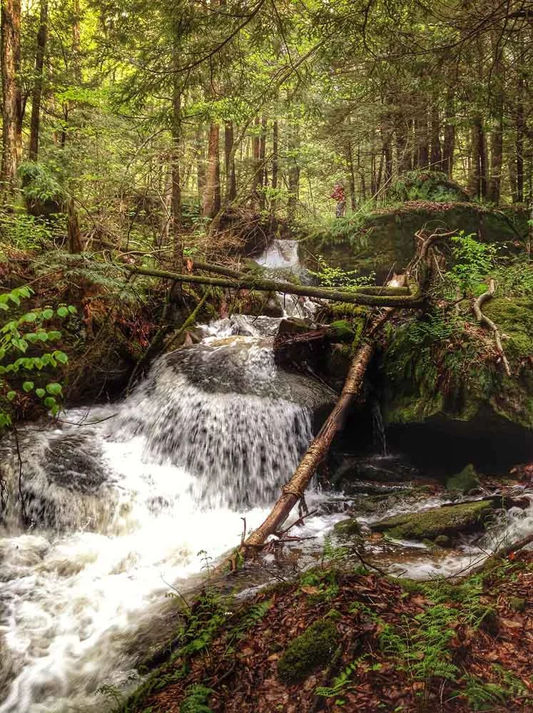
Backpacking: Morrison has become our kids favorite place to go backpacking. But we started small. If this is your first time out and you're not quite ready to tackle the whole trail, there are a couple established camping spots in the first few miles near where the trail crosses Morrison Run (pictured below). This area boasts small waterfalls in every direction and numerous big rock outcroppings and boulders, some setting upon each other creating cool little caves. On the flip side, if you're up for a good challenge, the entire 11.4 mile loop won't disappoint!
Useful info if you plan to check out Morrison trail: Morrison trailhead is located on State Route 59, about 18 miles east of Warren, PA. Facilities at the trailhead include ample parking, vault restroom and informational signage. No fees or permits are required for this trail. Trail leads to Morrison Campground, a primitive area of 38 boat/hiking access campsites, which have picnic tables, fire rings and vault toilets. Morrison campground no longer has pump water. Dispersed camping is permitted along the trail. Campfires are permitted in a fire ring only. If you choose to camp along the trail and are not within the boundary of Morrison Campground, a Forest Order requires that camps be set up a minimum of 1500 feet from the timber line of the reservoir. Please practice Leave No Trace - Pack It In, Pack It Out. Plan ahead - let someone know where you plan to hike and when you plan to return. There is no cell phone reception in this area.
Fees: No fee
Permit Info: No permit required
Water: None
Restroom: Vault restrooms available at Morrison campground.
North Country National Scenic Trail


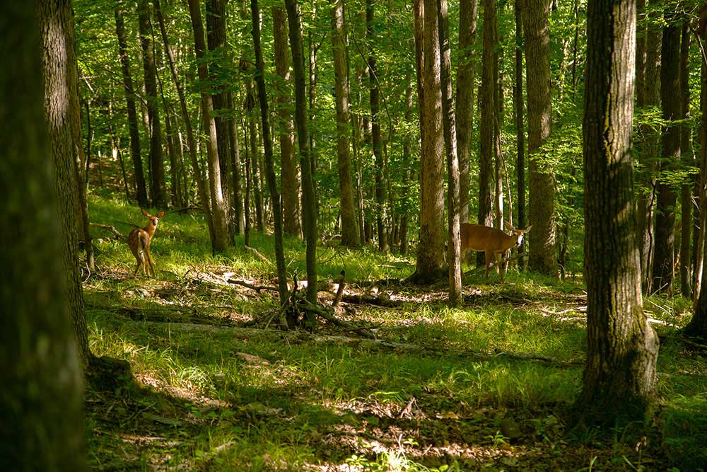


The North Country National Scenic Trail (NCNST) passes through approximately 95 miles of the Allegheny National Forest (ANF) as it travels across the Allegheny Plateau. Its northern terminus is the PA/NY border and its southern terminus is the ANF border, 3 miles north of Rt 66. This section of trail has much to offer; scenic views of the Allegheny reservoir, beautiful hemlock valleys, rock cities, fascinating evidence of past and present logging and oil industries and many opportunities to view wildlife, including bear, deer, coyote, fishers, bobcats, songbirds, grouse and eagles. Varied habitats and terrain, along with frequent camping sites make the North Country Trail (NCT) through the ANF a great destination for a day hike or a week long backpack.
There are many special places along the ANF section of the NCT. In Tracy Ridge, the trail runs on the eastern side of the Allegheny reservoir allowing for many scenic views and much solitude. The trail passes through the Tionesta Scenic Area where remnants can be found of an old growth forest that was mostly destroyed by a tornado in 1985. The trail now highlights the rebirth of this forest. Rock cities dot the terrain on many of the ridgelines. The most scenic of these are found in the popular Minister Creek valley.
Looking for a shuttle on the North Country Trail? We're here to help! Contact us for more info. Need a map? Find what you need in our online store. The Allegheny National Forest Chapter of the NCT is a very active group of volunteers that work hard to keep the trail in great shape. Connect with our local chapter of the NCT on Facebook, or visit their website.
Featured Sections
Solitude – 23.3 miles – Rt 346 at Willow Bay (N 41° 59.075’ W 078° 54.145’) to Rt 321 at Chapel Bay (N 41° 48.684’ W 078° 52.295’) – This section follows the eastern side of the Allegheny Reservoir allowing for many scenic views and varied terrain. The hiker passes through rock cities and lovely hemlock lined creek valleys. The Tracy Ridge area is a large roadless tract allowing for solitude and tranquility. This area also offers the opportunity to hike a loop by connecting to the Tracy Ridge National Forest trails. Great camping is found along the shore of the lake at Tracy Run, Johnnycake Run, Handsome Lake campground or Chappel Bay’s Hemlock Run. Beautiful camping spots are also located along Hammond Run and Hemlock Run.
Rebirth – 22.6 miles – Rt 321 at Red Bridge (N 41° 45.972’ W 078° 52.657’) to Rt 666 at Henrys Mills (N41°38.158’ W 079° 02.569’) – This section begins with a climb to a meadow holding sweeping view of the Kinzua Arm of the reservoir. It continues across Gibbs Hill to the Gibbs Spring shelter about 1 mile north of Rt 6. After crossing Rt 6, the trail passes through beautiful forest and interesting rock formations to the Tionesta Scenic Area. The remnants of this old growth forest were mostly destroyed by a tornado in 1985 and the trail highlights the rebirth of the forest. The trail continues through Cherry Run with a large rock city near its headwaters and great camping at its junction with the East Branch of the Tionesta Creek. The last segment of trail shows fascinating evidence of past and present oil and gas industries, including the foundation of a rod house just before the stunning switchback leading down into Henrys Mills.
Valleys – 15.7 miles – Rt 666 at Henrys Mills (N 41°38.158’ W 079° 02.569’) to Forest Road 116 (N41°40.274’ W 079° 13.584’) – The trail switchbacks up to an old rail road grade that was used in the early 1900s to transport timber to sawmills. An old rail car can be seen abandoned alongside the trail. Evidence of early equipment used for oil pumping is also visible here. Rolling hills take you through the scenic Upper Sheriff, Lower Sheriff, Fool’s Creek and Minister Creek valleys. A shelter is located on the Upper Sheriff and great camping is also found at the Lower Sheriff and Minister Creek valleys. Minister Creek valley, a proposed wilderness area, is a popular hiking destination with many beautiful rock cities.
Stidge – 14.0 miles – Forest Road 116 (N 41°40.274’ W 079° 13.584’) to Rt 666 Tionesta Bridge (N 41° 32.697’ W 79° 15.323’) – This section contains the least elevation change along the NCT in the ANF, but is among the most beautiful. It follows scenic hemlock lined creek valleys, passes over a tributary of Coalbed Run on the famous “stidge” (staircase bridge) and has a gushing spring, located on a 0.1 mile connector trail. The Queen Creek shelter is located 1.5 miles south of FR 116. Other camping is located along Coalbed Run, Beaver Run and East Fork. There is an Army Corps of Engineers Campground at the Tionesta Creek Bridge.
Beaver – 18.4 miles – Rt 666 Tionesta Bridge (N 41° 32.697’ W 79° 15.323’) to Rt 66 (N 41° 25.153’ W 79° 12.635’) – This section starts by following FR 127 for about a mile to another camping area along the Branch Creek. It then goes through a young forest regrowing since the 1985 tornado. Here it passes through a beautiful rock city. Next the trail parallels Four Mile Run before climbing over the ridge into Guiton Run. Several spots offer views of Salmon Creek valley. The picturesque Little Salmon Creek valley shows evidence of past beaver activity and nice camping by the bridge. Other camping is located in the Four Mile valley and at the Amsler Spring shelter. After the shelter, the trail crosses up and into the scenic Coon Creek valley and passes through State Game Lands #24 before arriving at the Rt 66 trailhead.
Rimrock Trail


This 1.3 mile trail offers a scenic 1 - 1 1/2 hour hike from Kinzua Beach to Rimrock Overlook. From the overlook visitors and hikers will be treated to outstanding views of the Allegheny Reservoir and surrounding hillsides. Visitors to the Overlook can explore the area's giant sandstone boulders, crefasses and rock outcrops. A set of stone steps, with handrail, allow visitors to climb "up" the boulders to the overlooks.
The majority of the trail is level with a gradual elevation change. As you climb up from the Kinzua Beach, the trail becomes steeper. The access road for the Overlook, from State Route 59, is designated as a 2.5 mile cross country ski trail during winter activity season
The trail passes through an area heavily forested with oak. The mast from the oak trees provides food for many wildlife, including bear, deer, grouse and turkey. Rimrock Overlook offers scenic views of Kinzua Bay, which extends southwest from the main body of the Allegheny Reservoir. Steps from the parking area to the overlook take visitors down a 200 foot elevation drop.
Find the US Forest Service brochure here.
Fees: No fee
Permit Info: No permit required
Water: None
Restroom: Vault restrooms available at Overlook parking area.
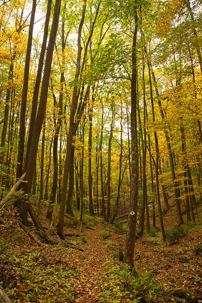
Tanbark Trail
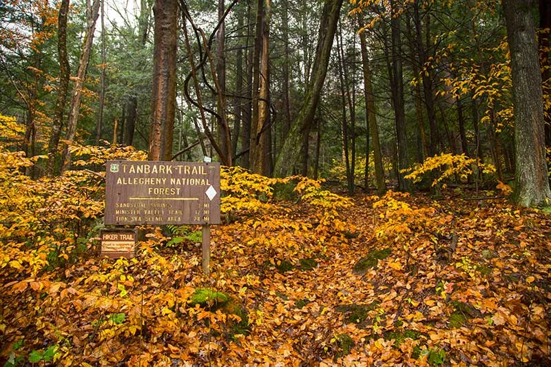


Tanbark is an 8.8 mile trail that traces the route used to skid timber during the turn-of-the-century tanning industry, which used hemlock bark as a source for curing leather. It's not a loop trail, so shuttling a vehicle (or an out-and-back hike) will be necessary. (We also offer vehicle shuttles.) It can also be used as part of an extended trip by tying into Hickory Creek Wilderness, the North Country National Scenic Trail (NCT), or Minister Creek. It's well blazed (white blazes) and established, and boasts impressive boulders, rock outcrops, and scenic streams. Over the years we've crossed paths with deer, fox and the occasional coyote while hiking Tanbark.
We may be a little biased having lived two miles from the trailhead for the last ten years, but Tanbark often times feels like the Allegheny National Forests best kept secret. We've hiked it hundreds of times and have only seen a handful of people while doing so. When folks ask us where they should day hike or backpack that's semi-close to town but will still feel like they've gotten away from it all, this is the trail we recommend.
Day Hike: If you're looking for a nice, easy hike we recommend the option of starting at Route 337 (depicted on the map as State Route 3005) and heading north toward US 62. You'll find level to rolling terrain with little elevation change. After patches of mountain laurel and crossing over Slater Run, the forest opens up and you're surrounded by an amazing sea of ferns under the towering canopy.
Backpacking: Tackling this 8.8 mile trail on a two or three-day backpacking trip is an excellent choice. Starting at the trailhead on US 62, it takes you alongside Boardinghouse Run, a beautiful creek with moss-covered boulders, cascades, and hemlocks. The most difficult terrain is found at this end, where the trail climbs roughly 800 feet over the first half mile. (We used this section of Tanbark for our training hikes leading up to our backpacking trip in the Grand Tetons last October.) Once the trail levels out, you'll find rolling and level terrain along the top of the plateau. From this point, ascents and descents reach 200 vertical feet where the trail crosses stream valleys and glens. The trail offers a couple nice (established) campsites before crossing Route 337 (roughly mile 3) and another between the Route 337 and Route 2002 crossing. Before reaching Route 2002 you'll come upon large rock formations, eventually taking you under and through large slabs of rock where you'll "thread the needle" through these ancient formations. Crossing Route 2002 leads you to Hearts Content Recreation Area and eventually Dunham Siding and the NCT.
Useful info if you plan to check out Tanbark trail: Trailhead is found on US 62 between Warren and Tidioute, and has no facilities. Two roadside pull-offs make up the parking area. No fees or permits are required for this trail. From US 62, this trail leads to Hearts Content Recreation Area, which has 26 family campsites and a large group area with picnic tables, fire rings and tent pads. Two campsites have lean-to shelters and charcoal grills. Vault toilets and pressurized water are also available. First come, first serve campsites are available. No reservations are accepted. Dispersed camping is permitted along the trail. Campfires are permitted in a fire ring only. Please practice Leave No Trace - Pack It In, Pack It Out. Plan ahead - let someone know where you plan to hike and when you plan to return. There is very limited cell phone reception in this area, with the only reception (Verizon) being near the trailhead at US 62.
Fees: No fee
Permit Info: No permit required
Water: None
Restroom: None
Tidioute Overlook Trail
Tidioute Overlook offers scenic views of Courson Island on the Allegheny River and the historic town of Tidioute, named for the Allegheny River with the Iroquoian word meaning "protrusion of land", which refers to the sharp bend in the Allegheny River where the town is located.
The paths from the parking area create a loop that go to the two overlooks. The path to the left will lead visitors to views of the 120 year old town of Tidioute, while heading to the right will take visitors to views of the Allegheny River Valley and Allegheny Wilderness Islands.
Operational Hours: Daylight hours; April 15 to October 10
Fees: No fee
Permit Info: No permit required
Water: None
Restroom: Vault restrooms available.
Timberdoodle Flats Interpretive Trail
Timberdoodle Flats Interpretive Trail is the perfect place to take kiddos, boasting flat terrain and numerous stops to learn about nature.
This trail is named for the American woodcock, also known as the timberdoodle, that uses both the forest and open areas for mating and nesting. This trail is a self-guided interpretive trail that offers a hardened trail for accessibility. The trailhead accesses two short interpretive loop trails, the 1/2 mile Bluebird Loop and the 1-1/4-mile Woodcock Loop. Both take visitors through a managed wildlife area.
Fees: No fee
Permit Info: No permit required
Water: None
Restroom: None
Restrictions: Hiking, cross-country skiing and mountain biking.


Tracy Ridge Trail System


The proposed Tracy Ridge Wilderness Area trail system is a bit more complex than Morrison and Tanbark, and much more remote. It's the closest thing to backcountry we've found in Pennsylvania... especially when you get out there in its nooks and crannies. Not only do you get the lush green of the forest, it also boasts some stunning views of Kinzua Lake and numerous small creeks that flow into it.
This trail system offers a smorgasbord of day hiking and backpacking options. Combined with the NCT and Johnnycake Trail, it includes various loops, connector trails, and spur trails that make up a complex 33.68-mile system. Always take a map on this trail. Depending on your route, the terrain is often level or rolling, but several ascents and descents range from 100 to 700 vertical feet and can be steep. Trails often follow narrow hillsides on steep embankments along streams and Kinzua Lake.
Camping options are just as plentiful with Hopewell and Handsome Lake campgrounds (boat/hike-in only shoreline campsites with picnic tables and fire rings, vault toilets, pump water and self-service pay station; $12/day). If you plan on staying at these campgrounds and have the option, a weekday stay is recommended, especially in July and August, as campsites fill up quickly by boaters. There are excellent dispersed campsites along the NCT as well.
We've seen deer, fox and raccoon from the trail, and been visited by coyotes while camping. Bear scat and prints cross our path occasionally, but surprisingly, we've never seen a bear on this trail.
Useful info if you plan to check out this trail: Tracy Ridge is located off of State Route 321 north of the junction of State Route 59 and south of the junction with State Route 346. Facilities include: 119 spacious family campsites with picnic tables, fire rings and tent pads, vault toilets, hand pumps and a trailer dump station. Group sites (entire camp loop) are available. Campsite reservations are accepted (1-877-444-NRRS, or the website). First come, first serve sites are also available. Please practice Leave No Trace - Pack It In, Pack It Out. Plan ahead - let someone know where you plan to hike and when you plan to return. There is no cell phone reception in this area.
Find the US Forest Service brochure here.
Fees: No fee
Permit Info: No permit required
Water: Yes
Restroom: Vault restrooms available.
Twin Lakes Trail
The Twin Lakes Trail is the second longest trail on the Allegheny. This 15.8 mile long trail begins at the long loop of the Black Cherry National Recreation Interpretive Trail located at Twin Lakes Recreation Area and travels west to join with the North Country National Scenic Trail.
The trail is marked with gray diamonds and is designated more difficult and is best suited to hikers and backpackers. At the Twin Lakes Recreation Area, the trail climbs from Hoffman Run over the plateau and then drops into the headwaters of Wolf Run on its way to South Branch Tionesta Creek. After crossing South Branch Tionesta Creek and then Crane Run, a designated wilderness trout stream, the trail then climbs into the Tionesta Scenic Area. Along the trial, Wolf Run, Tionesta Creek and Crane Run are popular trout fishing streams. Portions of the trail pass through oil and gas development fields. Some sections of the trail are wet depending on the time of year. The trail ends at the North Country National Scenic Trail in the Tionesta Scenic Area. From there hikers can continue north or south on the North Country National Scenic Trail.
Fees: No fee
Permit Info: No permit required
Water: None
Restroom: Vault
Find the US Forest Service brochure here.
Trailhead points for hiking trails in the Allegheny National Forest. Click a point to get directions from Google Maps.
Please remember - although close to our small towns, the Allegheny National Forest, at 517,000 acres, is vast and wild. Should you find yourself in an emergency situation on the trail, cell phone reception is very limited at best, often times nonexistent. Plan ahead. Let someone know where you're going and when you plan to return. Know the ability and skill level of those you're going with and don't overdo it. Always take a map. Although there is trail map signage, we've had experiences where maps were damaged by critters making them tough to read. Carry a day pack, even if you're only planning a short hike. It should include water, snacks, an extra layer of clothing, first aid kit and headlamp at the bare minimum. And please, please respect the trail. We love our forest. Pack it in, pack it out.